
IMAGES TAKEN NEAR TO
Copeswood Close, CHESTER, CH4 0PR
Introduction
This page details the photographs taken nearby to Copeswood Close, CH4 0PR by members of the Geograph project.
The Geograph project started in 2005 with the aim of publishing, organising and preserving representative images for every square kilometre of Great Britain, Ireland and the Isle of Man.

There are currently over 7.5m images from over14,400 individuals and you can help contribute to the project by visiting https://www.geograph.org.uk
Image Map
Images are licensed for reuse under creativecommons.org/licenses/by-sa/2.0
Notes
- Clicking on the map will re-center to the selected point.
- The higher the marker number, the further away the image location is from the centre of the postcode.
Image Listing (8 Images Found)
Images are licensed for reuse under creativecommons.org/licenses/by-sa/2.0
Image
Details
Distance
1
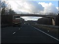
A55 - Green End farm accommodation bridge
Image: © Peter Whatley
Taken: 18 Jan 2011
0.11 miles
2
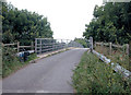
Farm Access
Bridge over A55 at Broughton providing access to Green End Farm.
Image: © Dennis Turner
Taken: 31 Aug 2005
0.11 miles
3
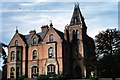
Broughton Hall, off Broughton Hall Road
This photo of Broughton Hall was taken by O.C.Remington a member of the USAF who was stationed at RAF Sealand in the mid 1950s. He and his family were accommodated at the hall during their time in UK, and his son and I both attended Broughton V.P. school. The hall was demolished for housing in the 1970s, and its location was close to the junction of Copper Beech Close with Forest Drive. His son C.Craig Remington has given me permission to submit the photo.
Image: © O.C.Remington
Taken: Unknown
0.13 miles
4
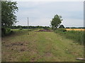
Former Track-bed of the Mold and Denbigh Junction Railway
The track-bed of the old railway which went from the North Wales mainline near Saltney to Denbigh, via Mold and Bodfari.
Image: © David Quinn
Taken: 29 Jun 2009
0.17 miles
5
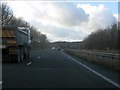
A55 south of Broughton
The A55 flirts with a gridline south of Broughton, but at this point immediately west of Green End farm's bridge is definitely still in SJ3363.
Image: © Peter Whatley
Taken: 18 Jan 2011
0.18 miles
6
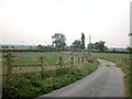
Greenways Court or Green End Farm?
At the north west corner of the grid square, it is Green End Farm on OS Explorer 266 and Greenways Court on OS Get a Map.
Image: © Dennis Turner
Taken: 31 Aug 2005
0.19 miles
7
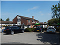
Offa's Dyke, Broughton
Part of the Greene King estate, this pub dates from the 1970s.
Image: © Stephen McKay
Taken: 28 Jun 2019
0.23 miles
8
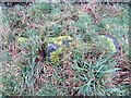
Old Boundary Marker near Greenways Court, Broughton
Parish Boundary Marker in parish of Dodleston (Chester District), by footpath in field south of the A55, beside a hedge. Dodleston/Hawarden parish boundary as well as England/Wales boundary.
Surveyed
Milestone Society National ID: CH_DODHAW04pb
Image: © John S Turner
Taken: 6 Feb 2017
0.23 miles