
IMAGES TAKEN NEAR TO
The Yews, CHESTER, CH4 0BX
Introduction
This page details the photographs taken nearby to The Yews, CH4 0BX by members of the Geograph project.
The Geograph project started in 2005 with the aim of publishing, organising and preserving representative images for every square kilometre of Great Britain, Ireland and the Isle of Man.

There are currently over 7.5m images from over14,400 individuals and you can help contribute to the project by visiting https://www.geograph.org.uk
Image Map
Images are licensed for reuse under creativecommons.org/licenses/by-sa/2.0
Notes
- Clicking on the map will re-center to the selected point.
- The higher the marker number, the further away the image location is from the centre of the postcode.
Image Listing (86 Images Found)
Images are licensed for reuse under creativecommons.org/licenses/by-sa/2.0
Image
Details
Distance
1
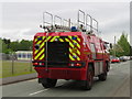
Simon Gloucester Saro fire engine in Saltney Ferry Road
The Hawarden Airport Fire Service Simon Gloucester Saro fire engine, registration L52 CAD, is seen here in Saltney Ferry Road, the B5129. The engine dates to 1994 and started life at the Fire Service College, Moreton in Marsh before moving to Filton. When Filton Airfield closed the fire engine moved again to Hawarden Airport which is near to where this photo was taken.
Image: © John S Turner
Taken: 8 May 2018
0.02 miles
2
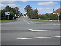
Saltney Ferry Road junction with Chester Road
Looking across the A5104 Chester Road to the B5129 Saltney Ferry Road.
Image: © John S Turner
Taken: 9 Sep 2009
0.04 miles
3
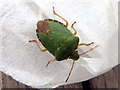
Common Green Shieldbug - Palomena Prasina
I was somewhat disconcerted to find this bug inside the house, and close to my lunch, but we both stayed calm, and I persuaded it to go back to the garden, where I'm sure it was much happier. See British Bugs: http://www.britishbugs.org.uk/heteroptera/Pentatomidae/palomena_prasina.html
Image: © John S Turner
Taken: 15 Oct 2014
0.04 miles
4
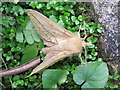
The Drinker moth - Euthrix potatoria (1)
Tidying up my overgrown garden disturbed this poor moth. It did settle again Image and I did then move it to a quieter place after photographing it. (Thanks to Hugh Venables for the identification) http://ukmoths.org.uk/show.php?id=4624
Image: © John S Turner
Taken: 7 Jul 2014
0.05 miles
5
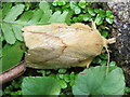
The Drinker moth - Euthrix potatoria (2)
Although I disturbed this poor moth from its daytime slumber Image, it seemed to settle again, albeit in full sun. I did move it to a more shaded area. (Thanks to Hugh Venables for the identification) http://ukmoths.org.uk/show.php?id=4624
Image: © John S Turner
Taken: 7 Jul 2014
0.05 miles
6
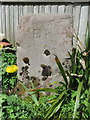
Old Boundary Marker in Saltney Ferry
Parish Boundary Marker from the parish of Dodleston (Chester District), was at Bretton Hall, is now in private garden in Saltney Ferry.
Inscription reads:-
D P
(Dodleston Parish)
Milestone Society National ID: CH_DODL01pb
Image: © John S Turner
Taken: Unknown
0.05 miles
7
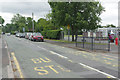
Saltney Ferry Road, Saltney
This is a stretch of the B5129 with Saltney Ferry County Primary School on the right.
Image: © Stephen McKay
Taken: 14 Jun 2018
0.06 miles
8
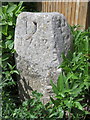
Old Boundary Marker in Saltney Ferry
Parish Boundary Marker from the parish of Dodleston (Chester District), was at Bretton Hall, is now in a private garden in Saltney Ferry.
This Boundary Stone pre-dates the 'Henry Hegg, Mayor, 1785' Chester City, Boundary Stones by two years.
Inscription reads:-
D P
1783
(Dodleston Parish)
and on the reverse:-
H P
(Hawarden Parish)
Milestone Society National ID: CH_DODHAW01pb
Image: © John S Turner
Taken: Unknown
0.06 miles
9
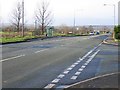
Road Junction at Saltney Ferry
The junction of the B5129 and the A5104, looking towards Broughton
Image: © John S Turner
Taken: 3 Dec 2006
0.06 miles
10
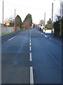
Saltney Ferry Road
This photo is taken in SJ3664. However, its purpose is to show how the road, which was completely straight in 1892, is now curved to go over the railway bridge in SJ3665. In 1892 there was only a level crossing to the left of where the bridge is now, but as the road and rail traffic became busier a bridge was built alongside so as not to cause disruption. When the bridge was completed the traffic was diverted over it and the crossing was closed. Subsequently a new locomotive shed was built on this side of the track and on top of the original road. The remains of the old road now provide access to the scrapyard that occupies the railway sidings.
Image: © John S Turner
Taken: 3 Dec 2006
0.06 miles