
IMAGES TAKEN NEAR TO
Church Street, CHESTER, CH3 8EB
Introduction
This page details the photographs taken nearby to Church Street, CH3 8EB by members of the Geograph project.
The Geograph project started in 2005 with the aim of publishing, organising and preserving representative images for every square kilometre of Great Britain, Ireland and the Isle of Man.

There are currently over 7.5m images from over14,400 individuals and you can help contribute to the project by visiting https://www.geograph.org.uk
Image Map
Images are licensed for reuse under creativecommons.org/licenses/by-sa/2.0
Notes
- Clicking on the map will re-center to the selected point.
- The higher the marker number, the further away the image location is from the centre of the postcode.
Image Listing (95 Images Found)
Images are licensed for reuse under creativecommons.org/licenses/by-sa/2.0
Image
Details
Distance
1
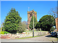
St Andrew's Church, Tarvin
St Andrew's Church seen from Church Street.
Image: © Jeff Buck
Taken: 19 Apr 2018
0.00 miles
3
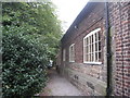
The Old Grammar School, Tarvin
Now in use as a church hall.
Image: © Jonathan Thacker
Taken: 22 Sep 2011
0.01 miles
4
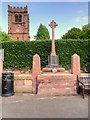
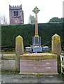
War Memorial and St Andrew's Church, Tarvin
The memorial stands alongside the road, outside St Andrew's Church. It is in the form of a sandstone cross. Metal plates on the base show the names of those of the district who lost their lives in the two world wars. The base carries the following inscription:
"THIS MEMORIAL
WAS ERECTED BY PUBLIC SUBSCRIPTION
TO THE GLORY OF GOD
AND IN GRATEFUL REMEMBRANCE
OF THE MEN OF THIS VILLAGE AND DISTRICT
WHO GAVE THEIR LIVES FOR THE RIGHT
IN THE GREAT WAR 1914 - 1918
GREATER LOVE HATH NO MAN THAN THIS,
THAT A MAN LAY DOWN HIS LIFE FOR HIS FRIENDS,
St John X V 13"
Image: © David Dixon
Taken: 7 Sep 2015
0.01 miles
5
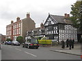
Church House, Tarvin
Dated about 1600. Beyond can be seen The Flaggs and Hamilton House of 1756.
Image: © Jonathan Thacker
Taken: 22 Sep 2011
0.01 miles
6
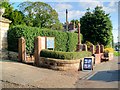
The War Memorial at Tarvin
The memorial stands alongside Church Street, outside St Andrew's Church. It is in the form of a sandstone cross. Metal plates on the base show the names of those of the district who lost their lives in the two world wars. The base carries the following inscription:
"THIS MEMORIAL
WAS ERECTED BY PUBLIC SUBSCRIPTION
TO THE GLORY OF GOD
AND IN GRATEFUL REMEMBRANCE
OF THE MEN OF THIS VILLAGE AND DISTRICT
WHO GAVE THEIR LIVES FOR THE RIGHT
IN THE GREAT WAR 1914 - 1918
GREATER LOVE HATH NO MAN THAN THIS,
THAT A MAN LAY DOWN HIS LIFE FOR HIS FRIENDS,
St John X V 13"
Image: © David Dixon
Taken: 7 Sep 2015
0.01 miles
9
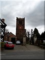
St Andrew's church, Tarvin
Originally built in the C12 but remodelled in the C13. Only the south wall of the present structure dates from this time. The remainder was built in the C15. Restorations were carried in the C18,C19 and 1908. There are cannon ball and musket shot marks on the church walls resulting from skirmishes fought during the civil war.
Image: © Bikeboy
Taken: 10 Apr 2014
0.01 miles
10

Church House and St Andrew's Tower, Tarvin
Part of Church House and the tower of St Andrew's church in Tarvin seen from Church Road.
Image: © Jeff Buck
Taken: 19 Apr 2018
0.02 miles