
IMAGES TAKEN NEAR TO
Platts Lane, CHESTER, CH3 7PG
Introduction
This page details the photographs taken nearby to Platts Lane, CH3 7PG by members of the Geograph project.
The Geograph project started in 2005 with the aim of publishing, organising and preserving representative images for every square kilometre of Great Britain, Ireland and the Isle of Man.

There are currently over 7.5m images from over14,400 individuals and you can help contribute to the project by visiting https://www.geograph.org.uk
Image Map
Images are licensed for reuse under creativecommons.org/licenses/by-sa/2.0
Notes
- Clicking on the map will re-center to the selected point.
- The higher the marker number, the further away the image location is from the centre of the postcode.
Image Listing (27 Images Found)
Images are licensed for reuse under creativecommons.org/licenses/by-sa/2.0
Image
Details
Distance
2
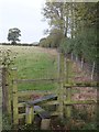
Stile into farmland at Hockenhull Platts
This stile is at the end of the surfaced road from Mon. To the east (right) is a small area of woodland. The steps of the stile have now been removed (2016), presumably because the concessionary Conservation Path it served expired in 2014, according to a notice I found nearby.
Image: © David Smith
Taken: 20 Oct 2011
0.10 miles
3
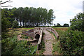
One of the "Roman" Bridges
Medieval bridge on the main packhorse route at Hockenhull Platts.
Image: © Andy Stephenson
Taken: 19 Jul 2005
0.10 miles
5
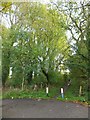
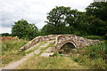
The Baker Way to Hockenhull Platts
The turning circle at the end of the surfaced road is obviously often used for people eating fast food (there was much more litter than is evident in this picture).
Image: © David Smith
Taken: 20 Oct 2011
0.12 miles
6

Marsh Marigolds at Hockenhull Platts
In the ditch beside the bridleway.
Image: © Dave Dunford
Taken: 14 Apr 2016
0.13 miles
7
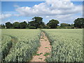
View of Footpath by Cotton Farm
A cracking footpath between Cotton Farm and Ford Bridge.
Image: © David Quinn
Taken: 3 Jul 2010
0.15 miles
8
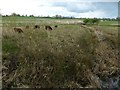
Cattle grazing for reserve management
Hockenhull Platts nature reserve. I walked this path just a week ago and the cattle (Dexters?) were wandering about in head-high reeds. If clearing reeds was the aim, it certainly works.
Image: © Dave Dunford
Taken: 25 Apr 2016
0.16 miles
9
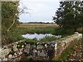
The westernmost of the three packhorse bridges ("Roman Bridges")
Pevsner claims that this bridge has been widened; however, only the approaches are wide, and it is not clear why anyone should have needed to widen this bridge, but the reason for the shape of the north side is not clear.
Image: © David Smith
Taken: 20 Oct 2011
0.17 miles
10
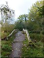
The westernmost packhorse bridge at Hockenhull Platts
Image: © David Smith
Taken: 20 Oct 2011
0.17 miles