IMAGES TAKEN NEAR TO
Barton Road, Kings Marsh, CHESTER, CH3 6NW
Introduction
This page details the photographs taken nearby to Barton Road, Kings Marsh, CH3 6NW by members of the Geograph project.
The Geograph project started in 2005 with the aim of publishing, organising and preserving representative images for every square kilometre of Great Britain, Ireland and the Isle of Man.

There are currently over 7.5m images from over14,400 individuals and you can help contribute to the project by visiting https://www.geograph.org.uk
Image Map
Images are licensed for reuse under creativecommons.org/licenses/by-sa/2.0
Notes
- Clicking on the map will re-center to the selected point.
- The higher the marker number, the further away the image location is from the centre of the postcode.
Image Listing (7 Images Found)
Images are licensed for reuse under creativecommons.org/licenses/by-sa/2.0
Image
Details
Distance
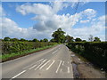
1
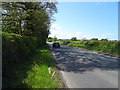
Barton Road (A534) towards Wrexham
Looking west.
Image: © JThomas
Taken: 4 May 2019
0.08 miles
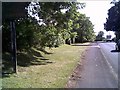
2

Grassland, Rowleyhill
Off Barton Road (A534).
Image: © JThomas
Taken: 4 May 2019
0.09 miles
3
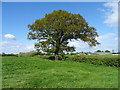
Hedgerow and mature tree, Rowleyhill
Off Barton Road (A534).
Image: © JThomas
Taken: 4 May 2019
0.12 miles
4
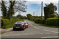
Barton Road
Barton Road, the old A41.
Image: © Peter McDermott
Taken: 30 Apr 2022
0.21 miles
5
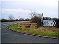
Road junction near Farndon
The junction of the A534 with the minor road to Crewe by Farndon. For the view in the opposite direction with a 19th century guidepost see Image
Image: © John S Turner
Taken: 17 Jan 2009
0.23 miles
6
B5130 going into Farndon
B5130 going into Farndon village near Chester, Summer 2004
Image: © chestertouristcom
Taken: 7 Jul 2004
0.23 miles
7
Minor road towards Crewe-by-Farndon
Looking south east.
Image: © JThomas
Taken: 4 May 2019
0.24 miles