IMAGES TAKEN NEAR TO
Barton Road, Kings Marsh, CHESTER, CH3 6NF
Introduction
This page details the photographs taken nearby to Barton Road, Kings Marsh, CH3 6NF by members of the Geograph project.
The Geograph project started in 2005 with the aim of publishing, organising and preserving representative images for every square kilometre of Great Britain, Ireland and the Isle of Man.

There are currently over 7.5m images from over14,400 individuals and you can help contribute to the project by visiting https://www.geograph.org.uk
Image Map (Loading...)


Getting Data...Please wait
Leaflet Map data © OpenStreetMap
Images are licensed for reuse under creativecommons.org/licenses/by-sa/2.0
Notes
- Clicking on the map will re-center to the selected point.
- The higher the marker number, the further away the image location is from the centre of the postcode.
Image Listing (6 Images Found)
Images are licensed for reuse under creativecommons.org/licenses/by-sa/2.0
Image
Details
Distance
2
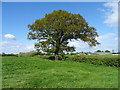
Hedgerow and mature tree, Rowleyhill
Off Barton Road (A534).
Image: © JThomas
Taken: 4 May 2019
0.13 miles
3
Byway approaching Rowley Hill Farm
Looking south on the Bishop Bennett Way.
Image: © JThomas
Taken: 4 May 2019
0.16 miles
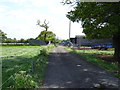
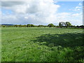
4

Grassland, Rowleyhill
Off Barton Road (A534).
Image: © JThomas
Taken: 4 May 2019
0.16 miles
5
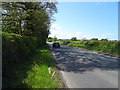
Barton Road (A534) towards Wrexham
Looking west.
Image: © JThomas
Taken: 4 May 2019
0.17 miles
6
Grassland near Rowley Hill Farm
Off the Bishop Bennett Way.
Image: © JThomas
Taken: 4 May 2019
0.18 miles