
IMAGES TAKEN NEAR TO
Chapel Lane, CHESTER, CH3 6EP
Introduction
This page details the photographs taken nearby to Chapel Lane, CH3 6EP by members of the Geograph project.
The Geograph project started in 2005 with the aim of publishing, organising and preserving representative images for every square kilometre of Great Britain, Ireland and the Isle of Man.

There are currently over 7.5m images from over14,400 individuals and you can help contribute to the project by visiting https://www.geograph.org.uk
Image Map
Images are licensed for reuse under creativecommons.org/licenses/by-sa/2.0
Notes
- Clicking on the map will re-center to the selected point.
- The higher the marker number, the further away the image location is from the centre of the postcode.
Image Listing (21 Images Found)
Images are licensed for reuse under creativecommons.org/licenses/by-sa/2.0
Image
Details
Distance
1
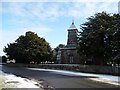
St Marys Church, on Chapel Lane, Bruera
Listed Grade 2*.
Image: © Christine Johnstone
Taken: 18 Jan 2015
0.02 miles
2
![St Marys churchyard, Bruera [1]](https://s3.geograph.org.uk/geophotos/04/31/85/4318599_28f3a61f_120x120.jpg)
St Marys churchyard, Bruera [1]
The southern side.
Image: © Christine Johnstone
Taken: 18 Jan 2015
0.02 miles
3
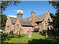
St Mary's Church, Bruera
The Grade II* listed St Mary's Church in Bruera.
Wikipedia https://en.wikipedia.org/wiki/St_Mary%27s_Church,_Bruera
Image: © Jeff Buck
Taken: 30 Aug 2022
0.02 miles
4
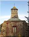
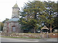
The tower and belfry of St Mary's Church, Bruera
The fabric of the present church dates from the Norman period and there have been a number of additions and restorations since. The Norman south doorway was rebuilt in the 14th century. Also in the 14th century and later windows were modified and in the 15th century a south chapel was added. A major restoration was carried out in 1896 by W. M. Boden at expense of the 1st Duke of Westminster involving the south porch and vestry, and a belfry was added.
Image: © Jeff Buck
Taken: 2 Mar 2012
0.02 miles
5
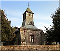
St Mary's Church, Bruera
The fabric of the present church dates from the Norman period and there have been a number of additions and restorations since. The Norman south doorway was rebuilt in the 14th century. Also in the 14th century and later windows were modified and in the 15th century a south chapel was added. A major restoration was carried out in 1896 by W. M. Boden at expense of the 1st Duke of Westminster involving the south porch and vestry, and a belfry was added.
Image: © Jeff Buck
Taken: 2 Mar 2012
0.02 miles
6
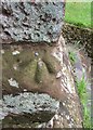
Ordnance Survey Rivet
This OS rivet can be found on the north face of St Mary's Church. It marks a point 19.044m above mean sea level.
Image: © Adrian Dust
Taken: 12 Jun 2016
0.03 miles
8
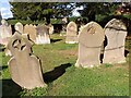
In the churchyard of St Mary's, Bruera
Old headstones in St Mary's churchyard.
Image: © Jeff Buck
Taken: 30 Aug 2022
0.03 miles
9
![St Marys churchyard, Bruera [2]](https://s3.geograph.org.uk/geophotos/04/31/86/4318603_c8e84239_120x120.jpg)
St Marys churchyard, Bruera [2]
The northern side.
Image: © Christine Johnstone
Taken: 18 Jan 2015
0.03 miles
10
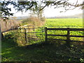
Field path leaving St Mary's Church through a kissing gate
Looking south-eastward.
Image: © Peter Wood
Taken: 17 Nov 2018
0.04 miles