
IMAGES TAKEN NEAR TO
Meadow Lane, CHESTER, CH3 6DQ
Introduction
This page details the photographs taken nearby to Meadow Lane, CH3 6DQ by members of the Geograph project.
The Geograph project started in 2005 with the aim of publishing, organising and preserving representative images for every square kilometre of Great Britain, Ireland and the Isle of Man.

There are currently over 7.5m images from over14,400 individuals and you can help contribute to the project by visiting https://www.geograph.org.uk
Image Map
Images are licensed for reuse under creativecommons.org/licenses/by-sa/2.0
Notes
- Clicking on the map will re-center to the selected point.
- The higher the marker number, the further away the image location is from the centre of the postcode.
Image Listing (26 Images Found)
Images are licensed for reuse under creativecommons.org/licenses/by-sa/2.0
Image
Details
Distance
1
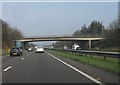
Chester bypass - Chester Road bridge, Huntington
Image: © Peter Whatley
Taken: 23 Mar 2012
0.08 miles
3

Chester Road Bridge
Bridge carrying the B5130, Chester Road, over the A55 at Huntington.
Image: © David Dixon
Taken: 9 Nov 2010
0.08 miles
4
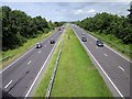
The A55(T) at Huntington
The A55(T) heading north east towards Great Boughton from the road bridge at Huntington.
Image: © Jeff Buck
Taken: 30 Jul 2012
0.10 miles
5
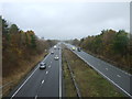
A55, Chester ring road
Looking north east from the bridge on the B5130.
Image: © JThomas
Taken: 12 Nov 2016
0.11 miles
6
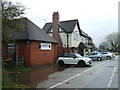
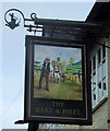
The Rake & Pikel Inn, Huntington
On Chester Road, Huntington.
A pikel is a pitchfork or hay fork.
Image: © JThomas
Taken: 12 Nov 2016
0.12 miles
8
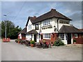
The Rake & Pikel, Huntington
The Rake & Pikel public house and restaurant in Huntington on the outskirts of Chester.
Image: © Jeff Buck
Taken: 30 Jul 2012
0.13 miles
9
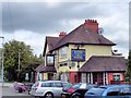
Huntington - Rake and Pikel pub
Huntington - Rake and Pikel PH on Chester Road (B5130).
Image: © Mike Harris
Taken: 25 Aug 2008
0.13 miles
10
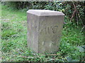
War Department Boundary Stone at Huntington
This war department boundary stone marks the boundary of the old Saighton Military Training Camp. Saighton Camp was built between 1938 and 1939 and was used as a military training camp during World War II. The area where the camp stood is now a modern housing estate. Another view of the stone from the rear Image
Image: © Jeff Buck
Taken: 16 Aug 2014
0.15 miles