
IMAGES TAKEN NEAR TO
Moorcroft Avenue, CHESTER, CH3 5QF
Introduction
This page details the photographs taken nearby to Moorcroft Avenue, CH3 5QF by members of the Geograph project.
The Geograph project started in 2005 with the aim of publishing, organising and preserving representative images for every square kilometre of Great Britain, Ireland and the Isle of Man.

There are currently over 7.5m images from over14,400 individuals and you can help contribute to the project by visiting https://www.geograph.org.uk
Image Map
Images are licensed for reuse under creativecommons.org/licenses/by-sa/2.0
Notes
- Clicking on the map will re-center to the selected point.
- The higher the marker number, the further away the image location is from the centre of the postcode.
Image Listing (50 Images Found)
Images are licensed for reuse under creativecommons.org/licenses/by-sa/2.0
Image
Details
Distance
1
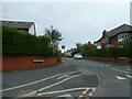
Road markings in Moorcroft Avenue, Chester
The pavement offers two crossings for cyclists; as the nearer one is surfaced in colour (and worn) and matches the cycle track along the pavement, it would seem that the cycle track has been moved further from the junction and not been surfaced to match
Image: © David Smith
Taken: 29 Apr 2024
0.05 miles
2
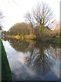
Shropshire Union canal
A view looking north across the Shropshire Union canal towards one of the new period style houses between the canal and Pearl Lane.
Image: © Phil Williams
Taken: 28 Dec 2006
0.07 miles
3
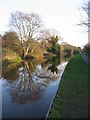
Shropshire Union reflections
A view looking to the southeast along the Shropshire Union canal.
Image: © Phil Williams
Taken: 28 Dec 2006
0.08 miles
4

Cottage
A cottage on the A5115, on the outskirts of Chester
Image: © Eirian Evans
Taken: 15 Mar 2006
0.10 miles
5
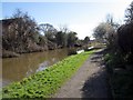
The Shropshire Union Canal, Boughton
Heading south east along the Shroppie towpath.
Image: © Jeff Buck
Taken: 6 Mar 2012
0.11 miles
6
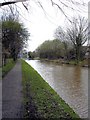
Great Boughton - the Shropshire Union Canal
Great Boughton. On the Shropshire Union Canal in this eastern suburb of Chester. Tarvin Lock just visible in the distance.The towpath here is part of the Baker Way.
Image: © Mike Harris
Taken: 16 Apr 2008
0.13 miles
7

Chester Boughton Hall Cricket Club
Lying between the Christleton Road to the south, and the Shropshire Union Canal to the north.
Image: © BrianPritchard
Taken: 9 Jan 2008
0.14 miles
8
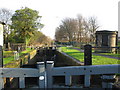
Tarvin Lock
A view looking to the southeast at Tarvin Lock. This is more accurately called Tarvin Road Lock , as the village of Tarvin is over 4 kilometres away from this point.
Image: © Phil Williams
Taken: 28 Dec 2006
0.15 miles
9
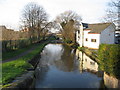
Shropshire Union canal
A view looking to the northwest along the Shropshire Union canal from the walkway on the lock gates at Tarvin Lock.
Image: © Phil Williams
Taken: 28 Dec 2006
0.15 miles
10
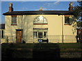
Keepers Cottage, Tarvin Lock
A view looking to the northeast to the Keepers Cottage at Tarvin Lock. This should be more accurately called Tarvin Road Lock, after the nearby A51 Tarvin Road, the village of Tarvin being over 4 kilometres away.
Image: © Phil Williams
Taken: 28 Dec 2006
0.15 miles