IMAGES TAKEN NEAR TO
Whitchurch Road, CHESTER, CH3 5QE
Introduction
This page details the photographs taken nearby to Whitchurch Road, CH3 5QE by members of the Geograph project.
The Geograph project started in 2005 with the aim of publishing, organising and preserving representative images for every square kilometre of Great Britain, Ireland and the Isle of Man.

There are currently over 7.5m images from over14,400 individuals and you can help contribute to the project by visiting https://www.geograph.org.uk
Image Map
Images are licensed for reuse under creativecommons.org/licenses/by-sa/2.0
Notes
- Clicking on the map will re-center to the selected point.
- The higher the marker number, the further away the image location is from the centre of the postcode.
Image Listing (65 Images Found)
Images are licensed for reuse under creativecommons.org/licenses/by-sa/2.0
Image
Details
Distance
1

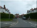
Whitchurch Road at Toll Bar Road junction
Image: © Colin Pyle
Taken: 28 Jan 2011
0.01 miles
3
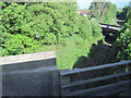
Railway line from Crewe approaching Chester from A55
Viewed from eastbound A55 bridge. The next bridge crossing the railway is Whitchurch road. The railway line is the main line from Crewe to North Wales
Image: © John Firth
Taken: 9 May 2011
0.04 miles

5

Toll Bar Road, Christleton
From Whitchurch Road.
Image: © Jaggery
Taken: 11 Oct 2009
0.05 miles
6

Old Boundary Marker by the A41, Whitchurch Road, Great Boughton Parish
Parish Boundary Marker by the A41, in parish of Great Boughton (Chester District), Whitchurch Road, by No. 60, in garden of No. 60.
Re-located from adjacent access lane.
Grade II listed. List Entry Number: 1229500
https://historicengland.org.uk/listing/the-list/list-entry/1229500
Surveyed
Milestone Society National ID: CH_GBOU01pb
Image: © Milestone Society
Taken: Unknown
0.05 miles
7

Old Boundary Marker by the A41, Whitchurch Road, Christleton parish
Parish Boundary Marker by the A41, in parish of Christleton (Chester District), Whitchurch Road, outside No 127.
Inscription reads:-
C P
1848
Grade II listed.
List Entry Number: 1130632 https://historicengland.org.uk/listing/the-list/list-entry/1130632
Surveyed
Milestone Society National ID: CH_CHRROW01pb
Image: © Milestone Society
Taken: Unknown
0.07 miles
9
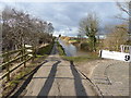
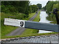
Shropshire Union Canal
Looking northwest from Lock No.9
Image: © Eirian Evans
Taken: 24 Feb 2016
0.08 miles