IMAGES TAKEN NEAR TO
Ince Lane, CHESTER, CH2 4JP
Introduction
This page details the photographs taken nearby to Ince Lane, CH2 4JP by members of the Geograph project.
The Geograph project started in 2005 with the aim of publishing, organising and preserving representative images for every square kilometre of Great Britain, Ireland and the Isle of Man.

There are currently over 7.5m images from over14,400 individuals and you can help contribute to the project by visiting https://www.geograph.org.uk
Image Map
Images are licensed for reuse under creativecommons.org/licenses/by-sa/2.0
Notes
- Clicking on the map will re-center to the selected point.
- The higher the marker number, the further away the image location is from the centre of the postcode.
Image Listing (15 Images Found)
Images are licensed for reuse under creativecommons.org/licenses/by-sa/2.0
Image
Details
Distance
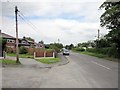
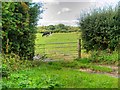
3
Wimbolds Trafford township
In the parish of St Mary Thornton le Moors.
Image: © Dennis Turner
Taken: 29 Aug 2005
0.10 miles
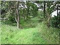
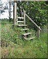
7
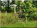
Footpath and Ladder Stile, Wimbolds Trafford
Image: © David Dixon
Taken: 5 Sep 2015
0.15 miles
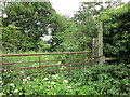
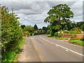
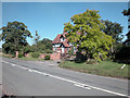
10
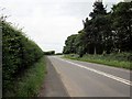
The B5132 near Wimbolds Trafford
The B5132 also known at this point as Ince Lane.
Image: © Jeff Buck
Taken: 2 Jun 2011
0.16 miles