
IMAGES TAKEN NEAR TO
Poole Lane, CHESTER, CH2 4JD
Introduction
This page details the photographs taken nearby to Poole Lane, CH2 4JD by members of the Geograph project.
The Geograph project started in 2005 with the aim of publishing, organising and preserving representative images for every square kilometre of Great Britain, Ireland and the Isle of Man.

There are currently over 7.5m images from over14,400 individuals and you can help contribute to the project by visiting https://www.geograph.org.uk
Image Map
Images are licensed for reuse under creativecommons.org/licenses/by-sa/2.0
Notes
- Clicking on the map will re-center to the selected point.
- The higher the marker number, the further away the image location is from the centre of the postcode.
Image Listing (29 Images Found)
Images are licensed for reuse under creativecommons.org/licenses/by-sa/2.0
Image
Details
Distance
1
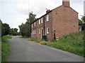
Thornton-le-Moors Village
Some very Cheshire-y houses in Thornton-le-Moors.
Image: © David Quinn
Taken: 8 Aug 2009
0.01 miles
2

Thornton-le-Moors
Thornton-le-Moors is a village seven miles north east of the city of Chester. At the census of 2011 it had a population of 253 (http://goo.gl/1T88T1 Office for National Statistics).
Immediately to the north of the village is the Stanlow Oil Refinery https://en.wikipedia.org/wiki/Stanlow_Refinery . This is the small green behind Image
Image: © David Dixon
Taken: 7 Sep 2015
0.05 miles
3
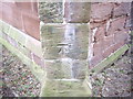
Cut Mark: St Mary's Church, Thornton Le Moors
OS Cut Mark on buttress of St Mary's Church, Thornton Le Moors. Number B10750 on Benchmark Database, see http://www.bench-marks.org.uk/bm37056
Image: © VBForever
Taken: 18 Feb 2011
0.05 miles
4

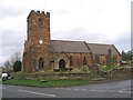
Thornton-le-Moors, St Mary's Church
St Mary's Church is a redundant Anglican church in the small village of Thornton-le-Moors.
The nave, chancel and south aisle of the present church, is built in red sandstone with slate roofs, date from the 14th century as does the south door. A chapel, the Elton Chapel, was added in the 16th century. The tower also dates from this time; it was damaged by fire in 1909 and was largely rebuilt in 1910. The church closed in 2002 and was vested in the Churches Conservation Trust in September 2009.
The church is recorded in the National Heritage List for England as a designated Grade I listed building (English Heritage Building ID: 55431 http://www.britishlistedbuildings.co.uk/en-55431-church-of-st-mary-thornton-le-moors-#.VfQC43mFOHs British Listed Buildings), and it is in the care of the Churches Conservation Trust http://www.visitchurches.org.uk/Ourchurches/Completelistofchurches/St-Marys-Church-ThorntonleMoors-Cheshire/ .
Image: © David Dixon
Taken: 7 Sep 2015
0.06 miles
5
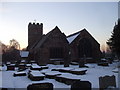
St Mary's Church, Thornton-le-Moors, Christmas Day 2010
Image: © John Lord
Taken: 25 Dec 2010
0.06 miles
7
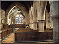
St Mary's Church, Thornton-le-Moors, interior
Image: © John Lord
Taken: 30 Dec 2010
0.06 miles
8
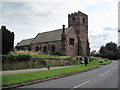
St. Mary's Church, Thornton-le-Moors
Please see http://en.wikipedia.org/wiki/St_Mary%27s_Church,_Thornton-le-Moors for more info.
Image: © David Quinn
Taken: 8 Aug 2009
0.06 miles
9
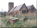
St Mary's, Thornton-le-Moors, from the graveyard
Image: © John Lord
Taken: 3 Jan 2007
0.06 miles
10
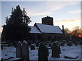
St Mary's Church, Thornton-le-Moors, on Christmas Day 2010
Image: © John Lord
Taken: 25 Dec 2010
0.06 miles