
IMAGES TAKEN NEAR TO
Warrington Road, CHESTER, CH2 4EA
Introduction
This page details the photographs taken nearby to Warrington Road, CH2 4EA by members of the Geograph project.
The Geograph project started in 2005 with the aim of publishing, organising and preserving representative images for every square kilometre of Great Britain, Ireland and the Isle of Man.

There are currently over 7.5m images from over14,400 individuals and you can help contribute to the project by visiting https://www.geograph.org.uk
Image Map
Images are licensed for reuse under creativecommons.org/licenses/by-sa/2.0
Notes
- Clicking on the map will re-center to the selected point.
- The higher the marker number, the further away the image location is from the centre of the postcode.
Image Listing (24 Images Found)
Images are licensed for reuse under creativecommons.org/licenses/by-sa/2.0
Image
Details
Distance
2
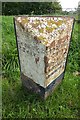
Old Milepost by the A56, Mickle Trafford
Cast iron post by the A56, in parish of Mickle Trafford (Chester District), North of Trafford House Farm, on the verge, on South-east side of road. Cast iron CCC1898, erected by the County Council in the 19th century.
Inscription reads:-
: CHESTER / 3 MILES : : CHESHIRE / 1898 / COUNTY COUNCIL : : DUNHAM HILL / 3 MILES / HELSBY 5 / FRODSHAM 8 / WARRINGTON 17 :
Maker:-
: W H SMITH & CO / MAKER / WHITCHURCH :
Milestone Society National ID: CH_CHWA03.
Image: © Milestone Society
Taken: 11 Oct 2017
0.12 miles
3
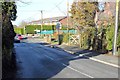
Station Lane, Mickle Trafford
Station Lane as it approaches The A56 (Warrington Road).
Wikipedia http://en.wikipedia.org/wiki/Mickle_Trafford
Image: © Jeff Buck
Taken: 14 Feb 2013
0.12 miles
4
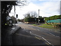
Crossroads in Mickle Trafford
Looking west in the direction of Chester from the centre of Mickle Trafford. before the M56 was built this was the main road between Chester and Frodsham and, without traffic lights, this is a very dangerous junction. Although still a busy 'A' road, traffic is now much reduced, and the pedestrian lights make crossing the road on foot a little safer.
Image: © John S Turner
Taken: 16 Jan 2010
0.13 miles
5
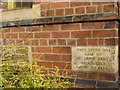
Two more foundation stones in the Primitive Methodist Chapel
These two foundation stones are to the right of the front door of the chapel. They are dated 5th November 1884, and were laid by Mrs H Lanceley of Chester, and Mrs John Jones of Chester. See also Image
Image: © John S Turner
Taken: 16 Jan 2010
0.13 miles
6
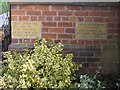
Two foundation stones in the Primitive Methodist Chapel
These two foundation stones are to the left of the front door and are dated 5th November 1884. They were laid by Mrs Wright of Trafford Hall, and Mrs Lewis of Wimbold's Trafford. There are two more foundation stones on the right hand side of the front door - Image
Image: © John S Turner
Taken: 16 Jan 2010
0.13 miles
7
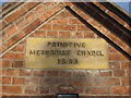
Plaque on the Primitive Methodist Chapel, Mickle Trafford
The plaque above the front door of the chapel confirms that it was built in 1885. See also Image
Image: © John S Turner
Taken: 16 Jan 2010
0.13 miles
8
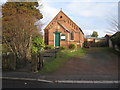
Primitive Methodist Chapel, Mickle Trafford
Looking across Station Lane towards the Primitive Methodist Chapel, which was built in 1885 - Image
Image: © John S Turner
Taken: 16 Jan 2010
0.13 miles
9
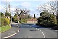
Station Lane, Mickle Trafford
Station Lane heading into the Village.
Wikipedia http://en.wikipedia.org/wiki/Mickle_Trafford
Image: © Jeff Buck
Taken: 14 Feb 2013
0.13 miles
10
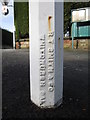
Maker's name on old signpost in Mickle Trafford
The old signpost dates to the late 19th century - Image - and the maker's name is:
R T SMITH & CO
WHITCHURCH SALOP
Image: © John S Turner
Taken: 16 Jan 2010
0.14 miles