
IMAGES TAKEN NEAR TO
Mannings Lane South, CHESTER, CH2 3RT
Introduction
This page details the photographs taken nearby to Mannings Lane South, CH2 3RT by members of the Geograph project.
The Geograph project started in 2005 with the aim of publishing, organising and preserving representative images for every square kilometre of Great Britain, Ireland and the Isle of Man.

There are currently over 7.5m images from over14,400 individuals and you can help contribute to the project by visiting https://www.geograph.org.uk
Image Map
Images are licensed for reuse under creativecommons.org/licenses/by-sa/2.0
Notes
- Clicking on the map will re-center to the selected point.
- The higher the marker number, the further away the image location is from the centre of the postcode.
Image Listing (35 Images Found)
Images are licensed for reuse under creativecommons.org/licenses/by-sa/2.0
Image
Details
Distance
1
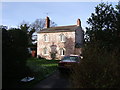
Rose Cottage
One of the older houses in this part of Hoole. It is recorded on an O S map dated 1869-74
Image: © BrianPritchard
Taken: 2 Feb 2008
0.01 miles
2
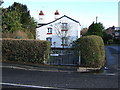
Ivy Cottage
Ivy Mews, off Mannings Lane South, is one of the older houses in this part of Newton. It is shown on an O S map dated 1938, but is of an earlier date
Image: © BrianPritchard
Taken: 31 Jan 2008
0.05 miles
3
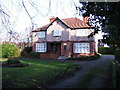
The Croft
The Croft is a former Barnardo's Home, now used by Cheshire County Council, on Mannings Lane South, Newton
Image: © BrianPritchard
Taken: 31 Jan 2008
0.05 miles
4
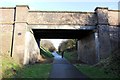
Mannings Lane Bridge
Mannings Lane bridge over the Millennium Greenway.
Image: © Jeff Buck
Taken: 19 Jan 2012
0.06 miles
5
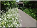
Yarrow beside the Millennium Greenway
Yarrow growing beside the Millennium Greenway near Kingsway at Chester.
Image: © Jeff Buck
Taken: 13 May 2020
0.07 miles
6
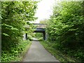
Mannings Lane South bridge over Chester Millennium Greenway
Image: © David Smith
Taken: 26 Apr 2024
0.07 miles
7
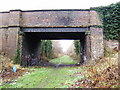
Mannings Lane South railway bridge
This disused Great Central railway connected Chester's Northgate Station to Liverpool & Manchester, via the connection to the main line at Mickle Trafford.
Image: © BrianPritchard
Taken: 26 Dec 2007
0.07 miles
9
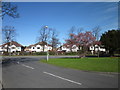
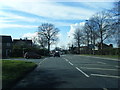
Pipers Lane, Hoole
Looking towards the junction with the A56 (Hoole Road).
Image: © Jeff Buck
Taken: 6 Mar 2012
0.12 miles
10
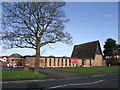
Hoole United Reformed Church, Chester
Hoole Congregational Church in Walker Street, Hoole, moved to this site on Hoole Road, and became Hoole United Reformed Church, opening its doors on 30th. March 1958. http://www.hooleonline.co.uk/churches.htm
Image: © BrianPritchard
Taken: 2 Feb 2008
0.14 miles