
IMAGES TAKEN NEAR TO
Oaklea Avenue, CHESTER, CH2 3RE
Introduction
This page details the photographs taken nearby to Oaklea Avenue, CH2 3RE by members of the Geograph project.
The Geograph project started in 2005 with the aim of publishing, organising and preserving representative images for every square kilometre of Great Britain, Ireland and the Isle of Man.

There are currently over 7.5m images from over14,400 individuals and you can help contribute to the project by visiting https://www.geograph.org.uk
Image Map
Images are licensed for reuse under creativecommons.org/licenses/by-sa/2.0
Notes
- Clicking on the map will re-center to the selected point.
- The higher the marker number, the further away the image location is from the centre of the postcode.
Image Listing (95 Images Found)
Images are licensed for reuse under creativecommons.org/licenses/by-sa/2.0
Image
Details
Distance
1
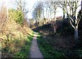
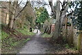
Newton Hollows
Newton Hollows is a medieval hollow way (or sunken lane) created over hundreds of years by the constant passage of people carts and animals. It originated as the Roman road between the legionary fortress of Chester and the important Roman manufacturing centre at Wilderspool (Warrington).
In the 12th century it was known as the 'Valley of the Demons'. It was thought to be haunted and travellers feared an encounter with the 'Hound of Hell', a 'huge slavering black dog with great white teeth like knives'.
The Hollows today is a 500 metre green corridor and public right of way and has a mix of large trees seasonal undergrowth.
Image: © Jeff Buck
Taken: 19 Jan 2012
0.02 miles
4
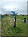
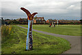
Sustrans milemarker, Newton, by Chester Millennium Greenway
Image: © David Smith
Taken: 26 Apr 2024
0.09 miles
7

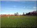
Newton Recreation Ground
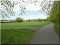
This urban recreation ground is undergoing a makeover with a multi sports area alongside the distant blue building. A small section of National Cycle Network Route 5, runs along the trees to the left of the picture.
Image: © Dennis Turner
Taken: 29 Jan 2006
0.10 miles
8
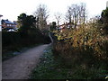
The Hollows
The view looking West-southwest, towards Newton Lane
Image: © BrianPritchard
Taken: 23 Dec 2007
0.10 miles
10
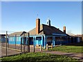
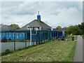
Kingsway Youth Centre
Situated next to the playing field.
Image: © Jeff Buck
Taken: 13 Jan 2012
0.10 miles