
IMAGES TAKEN NEAR TO
Greenfield Crescent, CHESTER, CH2 3NZ
Introduction
This page details the photographs taken nearby to Greenfield Crescent, CH2 3NZ by members of the Geograph project.
The Geograph project started in 2005 with the aim of publishing, organising and preserving representative images for every square kilometre of Great Britain, Ireland and the Isle of Man.

There are currently over 7.5m images from over14,400 individuals and you can help contribute to the project by visiting https://www.geograph.org.uk
Image Map
Images are licensed for reuse under creativecommons.org/licenses/by-sa/2.0
Notes
- Clicking on the map will re-center to the selected point.
- The higher the marker number, the further away the image location is from the centre of the postcode.
Image Listing (34 Images Found)
Images are licensed for reuse under creativecommons.org/licenses/by-sa/2.0
Image
Details
Distance

2

Warrington Road Bridge
Warrington Road Bridge lies over the Millennium Greenway.
Image: © Jeff Buck
Taken: 19 Jan 2012
0.10 miles
3
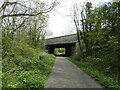
Warrington Road bridge over Chester Millennium Greenway
Image: © David Smith
Taken: 26 Apr 2024
0.11 miles
4

Pond at Hoole Hall
Ornamental pond and fountain in the grounds of Hoole Hall, an 18th century manor house which is now the Double Tree Hilton Hotel & Spa.
Image: © Des Blenkinsopp
Taken: 17 May 2019
0.11 miles
6
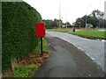
Greenfield Lane, Hoole
Showing position of Postbox No. CH2 111.
See Image] for postbox.
Image: © JThomas
Taken: 2 Sep 2024
0.12 miles
7

A56(T) Warrington Road Bridge
View looking south. These underpasses are popular with graffiti artists.
Image: © BrianPritchard
Taken: 30 Dec 2007
0.12 miles
8

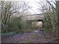
Hoole Village - bridge carrying the A41 over the disused Mickle Trafford railway
Hoole Village. Disused Mickle Trafford railway. Bridge carrying the A41 (Greenfield Lane) over the railway. On the route of the Longster Trail extension, which continues ahead to Chester city centre and beyond to the North Cheshire Way (Chester spur) at the Shropshire Union (Ellesmere) Canal.
Image: © Mike Harris
Taken: 16 Apr 2008
0.12 miles
9
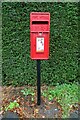
Elizabeth II postbox on the Greenfield Lane, Hoole
Postbox No. CH2 111.
See Image] for context.
Image: © JThomas
Taken: 2 Sep 2024
0.13 miles
10
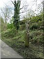
Wooden owl art in cutting of Chester Millennium Greenway
Image: © David Smith
Taken: 26 Apr 2024
0.14 miles