IMAGES TAKEN NEAR TO
Westminster Road, CHESTER, CH2 3DQ
Introduction
This page details the photographs taken nearby to Westminster Road, CH2 3DQ by members of the Geograph project.
The Geograph project started in 2005 with the aim of publishing, organising and preserving representative images for every square kilometre of Great Britain, Ireland and the Isle of Man.

There are currently over 7.5m images from over14,400 individuals and you can help contribute to the project by visiting https://www.geograph.org.uk
Image Map
Images are licensed for reuse under creativecommons.org/licenses/by-sa/2.0
Notes
- Clicking on the map will re-center to the selected point.
- The higher the marker number, the further away the image location is from the centre of the postcode.
Image Listing (158 Images Found)
Images are licensed for reuse under creativecommons.org/licenses/by-sa/2.0
Image
Details
Distance
1
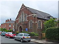
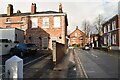
Hamilton Street Methodist Church, Chester
For the church website, see: http://www.hoolemethodistchurch.org.uk/ .
Image: © Bill Harrison
Taken: 30 Jun 2013
0.02 miles
5
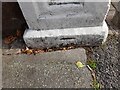
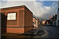
Ordnance Survey Cut Mark
This OS cut mark can be found at the junction of Hoole Road & Westminster Road. It marks a point 80.33ft above mean sea level.
Image: © Adrian Dust
Taken: 13 Sep 2022
0.04 miles
6
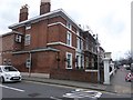
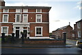
BaBa Guest House, Hoole Road
The birthplace of Group Captain Leonard Cheshire, a highly decorated RAF pilot who later founded a hospice that grew into the charity Leonard Cheshire Disability.
Image: © Eirian Evans
Taken: 22 Mar 2016
0.04 miles
7
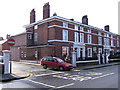
Birthplace of Leonard Cheshire VC
No. 65 Hoole Road was the birthplace of G/Capt Geoffrey Leonard Cheshire, Baron Cheshire,VC,DM,DSO and Two Bars,DFC, 7th. September 1917. http://en.wikipedia.org/wiki/Leonard_Cheshire#External_links
Image: © BrianPritchard
Taken: 2 Feb 2008
0.04 miles
8
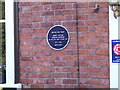
Leonard Cheshire VC
British RAF pilot G/Capt Geoffrey Leonard Cheshire VC, DM, DSO and Bars, DFC 1917-1992 Born Here. http://www.geograph.org.uk/photo/675071
Image: © BrianPritchard
Taken: 2 Feb 2008
0.04 miles
9
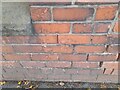
Ordnance Survey Cut Mark
This OS cut mark can be found on the wall between Nos 22 & 24 Hoole Road. It marks a point 25.226m above mean sea level.
Image: © Adrian Dust
Taken: 13 Sep 2022
0.04 miles