
IMAGES TAKEN NEAR TO
Westminster Court, CHESTER, CH2 3BF
Introduction
This page details the photographs taken nearby to Westminster Court, CH2 3BF by members of the Geograph project.
The Geograph project started in 2005 with the aim of publishing, organising and preserving representative images for every square kilometre of Great Britain, Ireland and the Isle of Man.

There are currently over 7.5m images from over14,400 individuals and you can help contribute to the project by visiting https://www.geograph.org.uk
Image Map
Images are licensed for reuse under creativecommons.org/licenses/by-sa/2.0
Notes
- Clicking on the map will re-center to the selected point.
- The higher the marker number, the further away the image location is from the centre of the postcode.
Image Listing (398 Images Found)
Images are licensed for reuse under creativecommons.org/licenses/by-sa/2.0
Image
Details
Distance
2
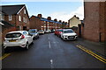
Westminster Road, Hoole, Chester
Wikipedia http://en.wikipedia.org/wiki/Hoole
Image: © Jeff Buck
Taken: 24 Jan 2013
0.02 miles
4
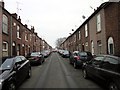
Junction of Westminster Road and Lightfoot Street, Chester
Wikipedia http://en.wikipedia.org/wiki/Hoole
Image: © Jeff Buck
Taken: 21 Jan 2013
0.03 miles
5
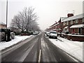
Lightfoot Street, Chester
Wikipedia http://en.wikipedia.org/wiki/Hoole
Image: © Jeff Buck
Taken: 21 Jan 2013
0.03 miles
6
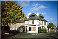
Drury House, Chester - September 1994
Drury House is located at the southern end of Westminster Road at the junction with Lightfoot Street. It was designed by Chester based architect John Douglas as a public house and built in 1877, however due to objections by the local temperance movement it was never granted a licence. It served as a shop and off-licence until the 1980s when it was sold as a private residence but due to its unusual design the building remained on the market for many years. This photo shows Drury House still boarded up in 1994. See also the same building in 2016 Image]
Source: Hoole History & Heritage Society
Image: © Jeff Buck
Taken: Unknown
0.03 miles
7
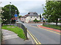
Looking down Westminster Road, Chester
Westminster Road crosses the railway on a narrow bridge, and is one-way, away from the photographer.
Image: © Bill Harrison
Taken: 30 Jun 2013
0.04 miles
8
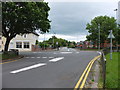
Suburban mini-roundabout
Lightfoot Street straight on, Westminster Road left-to-right.
Image: © Bill Harrison
Taken: 30 Jun 2013
0.04 miles
9
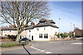
Road Junction on Lightfoot Street, Chester
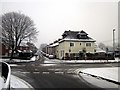
The mini-roundabout and junction of Lightfoot Street and Westminster Road. The unusual looking white building (actually a pink colour) is the former 'Drury House' which was a shop many years ago.
Image: © Jeff Buck
Taken: 14 Mar 2016
0.04 miles
10
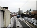
Crawfords Walk, Hoole, Chester
Wikipedia http://en.wikipedia.org/wiki/Hoole
Image: © Jeff Buck
Taken: 24 Jan 2013
0.04 miles