
IMAGES TAKEN NEAR TO
Parkgate Road, CHESTER, CH1 6JS
Introduction
This page details the photographs taken nearby to Parkgate Road, CH1 6JS by members of the Geograph project.
The Geograph project started in 2005 with the aim of publishing, organising and preserving representative images for every square kilometre of Great Britain, Ireland and the Isle of Man.

There are currently over 7.5m images from over14,400 individuals and you can help contribute to the project by visiting https://www.geograph.org.uk
Image Map
Images are licensed for reuse under creativecommons.org/licenses/by-sa/2.0
Notes
- Clicking on the map will re-center to the selected point.
- The higher the marker number, the further away the image location is from the centre of the postcode.
Image Listing (11 Images Found)
Images are licensed for reuse under creativecommons.org/licenses/by-sa/2.0
Image
Details
Distance
3
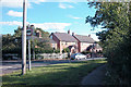
Cottages old and new
Modern versions of country cottages next to an older version on the left, half hidden behind the tree.
Image: © Dennis Turner
Taken: 28 Aug 2005
0.14 miles
4
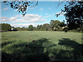
Grazing land
Close to Parkgate Road, fields nearby tend to be smaller than in the surrounding area.
Image: © Dennis Turner
Taken: 28 Aug 2005
0.14 miles
5
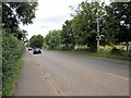
The A540 (Parkgate Road)
The A540 (Parkgate Road) heading north west away from Mollington towards the junction with the A5117.
Image: © Jeff Buck
Taken: 24 Aug 2012
0.17 miles
6
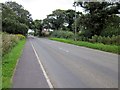
Church Road near Saughall
Church Road heading out of Saughall towards the A540 (Parkgate Road).
Image: © Jeff Buck
Taken: 24 Aug 2012
0.18 miles
7
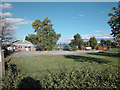
Garden Centre
Although surrounded by farmland, this Garden Centre is close to Coalpit Lane, which may indicate that coal was found nearby.
Image: © Dennis Turner
Taken: 28 Aug 2005
0.18 miles
8

Long Lane, Saughall
Entering Saughall along Long Lane.
Image: © Jeff Buck
Taken: 24 Aug 2012
0.22 miles
9

Parkgate Road
Road which almost diagonally bisects the square.
Image: © Dennis Turner
Taken: 28 Aug 2005
0.24 miles
10
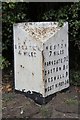
Old Milepost by the A540, opposite Newlands Farm
Cast iron post by the A540, in parish of SAUGHALL (CHESTER District), Saughall Nurseries, on the verge, on North East side of road. Cast iron CCC1896, erected by the County Council in the 19th century.
Inscription reads:-
: CHESTER / 4 MILES : : CHESHIRE / 1896 / COUNTY COUNCIL : : NESTON / 7 MILES / PARKGATE 7¾ / GAYTON 8¼ / HESWALL 9 / WEST KIRBY 14 :
Maker:-
: W H SMITH & CO / MAKER / WHITCHURCH :
Milestone Society National ID: CH_WKCH14.
Image: © J Higgins
Taken: 1 Jul 2004
0.25 miles