
IMAGES TAKEN NEAR TO
Church Road, CHESTER, CH1 6EF
Introduction
This page details the photographs taken nearby to Church Road, CH1 6EF by members of the Geograph project.
The Geograph project started in 2005 with the aim of publishing, organising and preserving representative images for every square kilometre of Great Britain, Ireland and the Isle of Man.

There are currently over 7.5m images from over14,400 individuals and you can help contribute to the project by visiting https://www.geograph.org.uk
Image Map
Images are licensed for reuse under creativecommons.org/licenses/by-sa/2.0
Notes
- Clicking on the map will re-center to the selected point.
- The higher the marker number, the further away the image location is from the centre of the postcode.
Image Listing (37 Images Found)
Images are licensed for reuse under creativecommons.org/licenses/by-sa/2.0
Image
Details
Distance
3
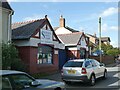
Saughall Service Station
A distinctive building with vehicle entry between the two gabled wings
Image: © David Smith
Taken: 7 May 2023
0.06 miles
4
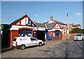
Saughall Service Station
Auto business in a nice old fashioned premises.
Image: © Des Blenkinsopp
Taken: 27 Feb 2013
0.07 miles
5
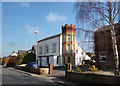
House With A Turret, Saughall
Quite an eclectic building in Church Road.
Image: © Des Blenkinsopp
Taken: 27 Feb 2013
0.08 miles
6
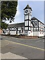
Vernon Institute, Saughall
The Vernon Institute (known locally as the V.I.) is located at the corner of Church Rd and Hermitage Rd. The building dates back to 1820 and is a well-known landmark in the village, of black and white design with an impressive clock tower.
Image: © Eirian Evans
Taken: 13 May 2021
0.11 miles
7
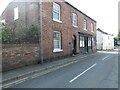
Former shop, now private house, Hermitage Road, Saughall
Image: © David Smith
Taken: 7 May 2023
0.11 miles
8
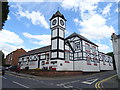
The Vernon Institute, Saughall
Grand village hall for the use of the inhabitants of Saughall.
Image: © JThomas
Taken: 15 Jun 2019
0.11 miles
9
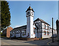
The Vernon Institute
Saughall's impressive village hall.
Image: © Des Blenkinsopp
Taken: 27 Feb 2013
0.11 miles
10
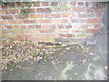
Cut Mark: Seahill Road, Saughall
OS Cut Mark on roadside wall, Seahill Road, Saughall. Very low to the ground, some of which is now actually below the pavement level which must have been redone at some point since the cut. Number B10746 on the Benchmark Database, see http://www.bench-marks.org.uk/bm37052
Image: © VBForever
Taken: 18 Feb 2011
0.12 miles