
IMAGES TAKEN NEAR TO
Catherine Street, CHESTER, CH1 4JZ
Introduction
This page details the photographs taken nearby to Catherine Street, CH1 4JZ by members of the Geograph project.
The Geograph project started in 2005 with the aim of publishing, organising and preserving representative images for every square kilometre of Great Britain, Ireland and the Isle of Man.

There are currently over 7.5m images from over14,400 individuals and you can help contribute to the project by visiting https://www.geograph.org.uk
Image Map
Images are licensed for reuse under creativecommons.org/licenses/by-sa/2.0
Notes
- Clicking on the map will re-center to the selected point.
- The higher the marker number, the further away the image location is from the centre of the postcode.
Image Listing (656 Images Found)
Images are licensed for reuse under creativecommons.org/licenses/by-sa/2.0
Image
Details
Distance
1
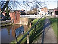
Williams Moorings
This canal basin links the Dee Basin with the Shropshire Union Canal, which is out of sight on the right. A deep lock beyond the white footbridge provides access to the higher level.
Image: © John S Turner
Taken: 6 Jan 2008
0.04 miles
2
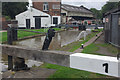
Lock no 1, Dee Branch, Shropshire Union Canal
This is the highest of three locks that give boats access to the River Dee.
Image: © Stephen McKay
Taken: 11 Sep 2013
0.04 miles
3
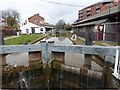
Dee Branch Top Lock, Shropshire Union Canal
Image: © Eirian Evans
Taken: 22 Mar 2016
0.04 miles
4

Dee Branch, Shropshire Union Canal
This arm leads down from the Shropshire Union Canal's main line through three locks to the River Dee. The owner of the boat in the foreground evidently has a sense of humour.
Image: © Stephen McKay
Taken: 11 Sep 2013
0.04 miles
5

Pist 'N' Broke, Shropshire Union Canal
An originally named narrow boat moored on the Shropshire Union Canal in the centre of Chester.
Image: © Graham Robson
Taken: 1 Apr 2017
0.04 miles
6
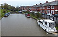
Moorings along the Shropshire Union Canal (Dee Branch)
The houses are along Whipcord Lane.
Image: © Mat Fascione
Taken: 14 Apr 2019
0.04 miles
7
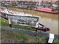
William's Moorings, Chester
Williams Moorings is a minor waterways place on the Shropshire Union Canal between River Dee Branch Junction to the north and River Dee Junction to the southwest.
Image: © Eirian Evans
Taken: 22 Mar 2016
0.04 miles
8
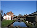
Lock between the Dee Basin and the Shropshire Union Canal
This lock links the Shropshire Union Canal, which is beyond the far gate, with the Dee basin and the River Dee. The Graving Dock is the building on the right - see Image
Image: © John S Turner
Taken: 6 Jan 2008
0.04 miles
9
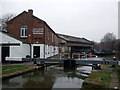
Chester Canal Warehouse Workshop
Dates back to the 1840's. The lock gate in mid centre actually forms part of a graving lock for repairs when required.
Image: © Richard Hoare
Taken: 11 Feb 2012
0.04 miles
10
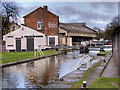
Graving Lock on Canal Link to River Dee
This lock was constructed during the first half of the nineteenth century, to connect Chester's inland port, known as 'Tower Wharf' with the Dee branch (and hence the River Dee). The wharf was a major cargo terminal, utilising narrowboats and larger 'Mersey Flats', and was also a starting point for passengers travelling to Liverpool. The lock is Grade II-listed (Historic England List Entry Number: 1375932 https://historicengland.org.uk/listing/the-list/list-entry/1375932 ).
The buildings behind the lock formed Taylor’s Boatyard which was established in the late-1840s/1850s by the Shropshire Union Railways & Canal Company as their major boat building and repair yard, and the majority of the yard's surviving buildings are believed to have been constructed at this time. It is a Grade II listed building (Historic England List Entry Number: 1375715 https://historicengland.org.uk/listing/the-list/list-entry/1375715 ).
Image: © David Dixon
Taken: 25 Jan 2019
0.04 miles