
IMAGES TAKEN NEAR TO
Catherine Street, CHESTER, CH1 4JY
Introduction
This page details the photographs taken nearby to Catherine Street, CH1 4JY by members of the Geograph project.
The Geograph project started in 2005 with the aim of publishing, organising and preserving representative images for every square kilometre of Great Britain, Ireland and the Isle of Man.

There are currently over 7.5m images from over14,400 individuals and you can help contribute to the project by visiting https://www.geograph.org.uk
Image Map
Images are licensed for reuse under creativecommons.org/licenses/by-sa/2.0
Notes
- Clicking on the map will re-center to the selected point.
- The higher the marker number, the further away the image location is from the centre of the postcode.
Image Listing (610 Images Found)
Images are licensed for reuse under creativecommons.org/licenses/by-sa/2.0
Image
Details
Distance
1
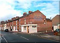
Fish & Chips & Bovril
Ghost sign on the chippy wall on the corner of Charlotte Street.
The remains of the old painted street names are there as well.
Image: © Des Blenkinsopp
Taken: 11 Apr 2012
0.04 miles
2
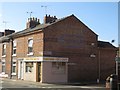
Takeaway, South View Road, Chester
A fish and chip takeaway on the corner of South View Road and Charlotte Street, Chester. A fading ghost sign for Bovril can just about be distinguished on the brickwork of the building's gable wall.
Image: © Graham Robson
Taken: 1 Apr 2017
0.04 miles
3
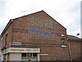
Bovril, For Real Beef Flavour
Fading Bovril advert on the side of a chippy. Junction of Charlotte Street and Bouverie Street, Chester.
Image: © Jeff Buck
Taken: 4 Jul 2009
0.04 miles
4
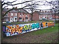
Graffiti in The Cop park
This old brick building looks as though it once was an air raid shelter serving the nearby terraced houses. As the building faces a high bank in a park I think the graffiti serves to enhance rather than detract from this utilitarian structure. Sealand Road runs between the houses and the building, and the River Dee is behind the camera. See also Image
Image: © John S Turner
Taken: 31 Dec 2007
0.06 miles
5
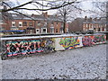
Graffiti in The Cop park - December 2010
This old air raid shelter is hidden between a hedge and a high bank between Sealand Road and the River Dee. It has long been a 'canvas' for the local artists and I photographed it first in December 2007 Image See also: Image 2012 (Des Blenkinsopp), and Image
Image: © John S Turner
Taken: 20 Dec 2010
0.06 miles
6
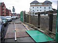
Collapsed hoardings on Sealand Road
Strong winds at the end of December caused several hoardings to be blown down. This plot on the right of Sealand Road is next to the River Dee and is awaiting development. The Dee Lock, between the River Dee and the Dee Basin, is in front of the large modern building on the right.
Image: © John S Turner
Taken: 31 Dec 2007
0.06 miles
7

Chester Deaf Centre by night
The building (built in 1894) was originally a church. Now it functions as a centre for the deaf community and its hall is used for social activities.
Image: © David Smith
Taken: 20 Oct 2011
0.06 miles
8

Chester Deaf Centre
The building (built in 1894) was originally a church. Now it functions as a centre for the deaf community and its hall is used for social activities.
Image: © David Smith
Taken: 20 Oct 2011
0.06 miles
9

Entrance to The Cop park
This is the eastern entrance to The Cop park. Sealand Road is to the right, and the tidal River Dee flows a short distance away on the other side of the narrow park.
Image: © John S Turner
Taken: 31 Dec 2007
0.06 miles
10

Graffiti in The Cop park - January 2015
This old air raid shelter is hidden between a hedge and a high bank between Sealand Road and the River Dee. It has long been a 'canvas' for the local artists and I photographed it first in December 2007 Image
Image: © John S Turner
Taken: 3 Jan 2015
0.06 miles