
IMAGES TAKEN NEAR TO
New Crane Street, CHESTER, CH1 4HZ
Introduction
This page details the photographs taken nearby to New Crane Street, CH1 4HZ by members of the Geograph project.
The Geograph project started in 2005 with the aim of publishing, organising and preserving representative images for every square kilometre of Great Britain, Ireland and the Isle of Man.

There are currently over 7.5m images from over14,400 individuals and you can help contribute to the project by visiting https://www.geograph.org.uk
Image Map
Images are licensed for reuse under creativecommons.org/licenses/by-sa/2.0
Notes
- Clicking on the map will re-center to the selected point.
- The higher the marker number, the further away the image location is from the centre of the postcode.
Image Listing (604 Images Found)
Images are licensed for reuse under creativecommons.org/licenses/by-sa/2.0
Image
Details
Distance


3

The old dock area on the Dee in Chester
The wharf was developed in the second half of the 18th C and could take sea-going vessels up to 350 tons. A new walkway has been built directly over the former quay.
Image: © Eirian Evans
Taken: 1 Mar 2012
0.02 miles
4

Children's Play Area near Crane Wharf, Chester
Image: © Jeff Buck
Taken: Unknown
0.02 miles
5

Riverwall Path and the River Dee
This modern walkway and cycle path is along the bank of the River Dee by The Wharf housing development. It has been incorporated into a flood defence scheme along with housing development and regeneration of the area.
Image: © John S Turner
Taken: 20 Oct 2007
0.02 miles
6
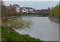
Apartments along the River Dee in Chester
Image: © Mat Fascione
Taken: 14 Apr 2019
0.02 miles
7

Pseudo canal lift bridge
This pseudo canal lift bridge serves no useful purpose other than as a design link with the nearby canal. The modern development faces the River Dee and is built on what used to be a wharf area.
Image: © John S Turner
Taken: 20 Oct 2007
0.02 miles
8

Crane Wharf
Watergate Building, the building to the right of centre of the picture is an early 18th. century former wharf side warehouse now used as multi-occupancy business units with motor repair business on the ground floor. In the early 1980s a combination of an unusually high tide, heavy rain and surface water caused flooding of the car park and the building up to a depth of up to 18 inches.
Image: © Dennis Turner
Taken: 31 May 2009
0.02 miles
9

New Crane Street
To the right of the picture are apartment blocks on the former Dee basin and to the left the site of the former boatyard on the adjoining River Dee.
Image: © Dennis Turner
Taken: 31 May 2009
0.02 miles
10

Dee Lock
Debris brought up the river on a high tide.
Image: © Dennis Turner
Taken: 31 May 2009
0.02 miles