
IMAGES TAKEN NEAR TO
St. Anne Street, CHESTER, CH1 3HZ
Introduction
This page details the photographs taken nearby to St. Anne Street, CH1 3HZ by members of the Geograph project.
The Geograph project started in 2005 with the aim of publishing, organising and preserving representative images for every square kilometre of Great Britain, Ireland and the Isle of Man.

There are currently over 7.5m images from over14,400 individuals and you can help contribute to the project by visiting https://www.geograph.org.uk
Image Map
Images are licensed for reuse under creativecommons.org/licenses/by-sa/2.0
Notes
- Clicking on the map will re-center to the selected point.
- The higher the marker number, the further away the image location is from the centre of the postcode.
Image Listing (1197 Images Found)
Images are licensed for reuse under creativecommons.org/licenses/by-sa/2.0
Image
Details
Distance
1

St Anne's flats in St Anne Street
The north east face of St Anne's flats as seen from St Anne Street.
Image: © John S Turner
Taken: 20 May 2008
0.00 miles
2

Ordnance Survey Cut Mark
This OS cut mark can be found on No42 St Anne Street. It marks a point 21.034m above mean sea level.
Image: © Adrian Dust
Taken: 13 Sep 2022
0.03 miles
3
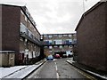
Henry Place, Newtown, Chester
Wikipedia http://en.wikipedia.org/wiki/Newtown,_Chester
Image: © Jeff Buck
Taken: 22 Jan 2013
0.03 miles

5
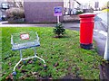
A Merry Christmas from Newtown, Chester
A wonderfully festive scene on St Anne Street in Newtown, Chester. As Tiny Tim said 'God bless us, every one!'
Image: © Jeff Buck
Taken: 24 Dec 2022
0.03 miles
6

St Anne Street Fire Station
The front of the St Anne Street fire station. The brick column on the left is the south east corner of the Northgate Arena swimming pool and sports centre.
Image: © John S Turner
Taken: 20 May 2008
0.04 miles
7

Footpath and trees in Newtown
A footpath and trees between the Newtown flats and the St Oswald's Way inner ring road.
Image: © John S Turner
Taken: 6 Oct 2008
0.04 miles
8

Excavating part of the George Street car park
This part of the George Street car park is to be redeveloped and, in advance of that, archaeological excavations are taking place. The area's terraced housing was demolished in the 1960s and 1970s in part to make way for the inner ring road - seen here on the right. In the foreground buildings alongside Oulton Place will be uncovered, and at the far end of the site Kinaston Street (later Kynaston St) has already been uncovered. It will be interesting to see what lies beneath these 19th century remains.
Image: © John S Turner
Taken: 6 Aug 2009
0.05 miles
9
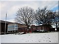
Chester Fire Station, Newtown, Chester
Wikipedia http://en.wikipedia.org/wiki/Newtown,_Chester
Image: © Jeff Buck
Taken: 22 Jan 2013
0.05 miles
10

Northgate Arena - south east corner
The Northgate Arena swimming pool and sports centre is arguably one of the better buildings to have been built in Chester in the latter part of the 20th century. This is the south east corner, which shows some of the buildings design features.
Image: © John S Turner
Taken: 20 May 2008
0.05 miles