
IMAGES TAKEN NEAR TO
St. Oswalds, CHESTER, CH1 3HW
Introduction
This page details the photographs taken nearby to St. Oswalds, CH1 3HW by members of the Geograph project.
The Geograph project started in 2005 with the aim of publishing, organising and preserving representative images for every square kilometre of Great Britain, Ireland and the Isle of Man.

There are currently over 7.5m images from over14,400 individuals and you can help contribute to the project by visiting https://www.geograph.org.uk
Image Map
Images are licensed for reuse under creativecommons.org/licenses/by-sa/2.0
Notes
- Clicking on the map will re-center to the selected point.
- The higher the marker number, the further away the image location is from the centre of the postcode.
Image Listing (790 Images Found)
Images are licensed for reuse under creativecommons.org/licenses/by-sa/2.0
Image
Details
Distance
1
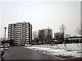
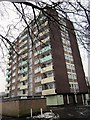
Newtown Tower Blocks, Chester
St Annes, St Oswalds and St Georges tower blocks were built in the 1960's.
Wikipedia http://en.wikipedia.org/wiki/Newtown,_Chester
Image: © Jeff Buck
Taken: 23 Jan 2013
0.02 miles
2
Stuart Place, Newtown, Chester
Wikipedia http://en.wikipedia.org/wiki/Newtown,_Chester
Image: © Jeff Buck
Taken: 22 Jan 2013
0.03 miles
3
Henry Place, Newtown, Chester
Wikipedia http://en.wikipedia.org/wiki/Newtown,_Chester
Image: © Jeff Buck
Taken: 22 Jan 2013
0.03 miles
4
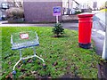
A Merry Christmas from Newtown, Chester
A wonderfully festive scene on St Anne Street in Newtown, Chester. As Tiny Tim said 'God bless us, every one!'
Image: © Jeff Buck
Taken: 24 Dec 2022
0.04 miles
6

Ordnance Survey Cut Mark
This OS cut mark can be found on No42 St Anne Street. It marks a point 21.034m above mean sea level.
Image: © Adrian Dust
Taken: 13 Sep 2022
0.04 miles
7

Footpath and trees in Newtown
A footpath and trees between the Newtown flats and the St Oswald's Way inner ring road.
Image: © John S Turner
Taken: 6 Oct 2008
0.04 miles
8

Walkway to Wellington Place
Hoole Road is behind the camera with St Oswald's Way beyond the line of trees to the left.
Image: © John S Turner
Taken: 20 May 2008
0.04 miles
9

Walkway alongside St Oswald's Way
The attractive trees alongside this path disguise the very busy inner ring road, St Oswald's Way, to the left.
Image: © John S Turner
Taken: 20 May 2008
0.04 miles
10

Lyon Street and St Anne's park and playground
Looking along Lyon Street in Newtown adjacent to St Anne's park and playground.
Image: © John S Turner
Taken: 6 Oct 2008
0.05 miles