
IMAGES TAKEN NEAR TO
St. Anne Street, CHESTER, CH1 3HU
Introduction
This page details the photographs taken nearby to St. Anne Street, CH1 3HU by members of the Geograph project.
The Geograph project started in 2005 with the aim of publishing, organising and preserving representative images for every square kilometre of Great Britain, Ireland and the Isle of Man.

There are currently over 7.5m images from over14,400 individuals and you can help contribute to the project by visiting https://www.geograph.org.uk
Image Map
Images are licensed for reuse under creativecommons.org/licenses/by-sa/2.0
Notes
- Clicking on the map will re-center to the selected point.
- The higher the marker number, the further away the image location is from the centre of the postcode.
Image Listing (650 Images Found)
Images are licensed for reuse under creativecommons.org/licenses/by-sa/2.0
Image
Details
Distance
1

Rivet bench mark in St Anne's Street
This rivet bench mark is on the corner of 117 St Anne's Street, Newtown, and the sloping stonework has been cut flat to allow the rivet and survey staff to stand vertically. The centre leg of the cut mark has a modern plug where a damp-proofing procedure has been carried out.
Image: © John S Turner
Taken: 1 Apr 2010
0.01 miles
2

Ordnance Survey Rivet
This OS rivet can be found on No117 St Anne Street. It marks a point 20.269m above mean sea level.
Image: © Adrian Dust
Taken: 13 Sep 2022
0.01 miles
3
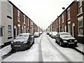
Walter Street, Newtown, Chester
Wikipedia http://en.wikipedia.org/wiki/Newtown,_Chester
Image: © Jeff Buck
Taken: 21 Jan 2013
0.01 miles
4
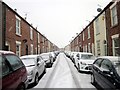
Talbot Street, Newtown, Chester
Wikipedia http://en.wikipedia.org/wiki/Newtown,_Chester
Image: © Jeff Buck
Taken: 21 Jan 2013
0.02 miles
5
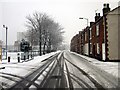
St Ann Street, Newtown, Chester
Wikipedia http://en.wikipedia.org/wiki/Newtown,_Chester
Image: © Jeff Buck
Taken: 21 Jan 2013
0.02 miles
6

St Anne's Doorstep Green and St George's flats
Looking across the corner of 'St Anne's Doorstep Green' towards St George's flats. This open space, alongside St Anne Street in Newtown, was redeveloped in 2004 following local consultation, and was funded by several groups - see Image This corner provides a seating area looking across the 'kickabout' field to the left.
Image: © John S Turner
Taken: 20 May 2008
0.03 miles
7
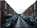
Talbot Street, Newton, Chester
A street of terraced housing.
Image: © JThomas
Taken: 12 Nov 2016
0.03 miles
8

St Anne's Doorstep Green sign
This green space and playground is a great resource for the residents in the St Anne Street area.
Image: © John S Turner
Taken: 20 May 2008
0.03 miles
9
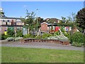
St Anne's Doorstep Green seating area
This seating area is in the north west corner of 'St Anne's Doorstep Green'. This green space was redeveloped in 2004 to provide a more useful area for the local youngsters. St Anne Street is on the right with the Salvation Army building visible on the other side of the road.
Image: © John S Turner
Taken: 20 May 2008
0.03 miles
10

Black Diamond Street
Small trading estate in Newtown utilising buildings formerly used by the GPO for special sorting office of mail and also repair and maintenance of GPO telephone and Royal Mail vehicles. Before this the site was used as the coal distribution yard for the nearby railway. Modern town houses have recently replaced these business premises.
Image: © Dennis Turner
Taken: 2 Oct 2003
0.03 miles