1
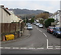
Llanarth Street, Machen
Ascending from the A468. Maps show the A468 Commercial Road
to the right of this junction and the A468 Chatham to the left.
Image: © Jaggery
Taken: 4 Jan 2019
0.01 miles
2
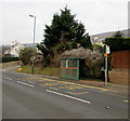
Chatham bus stop and shelter, Machen
The stop alongside the A468 Chatham is for buses to Newport.
Image: © Jaggery
Taken: 4 Jan 2019
0.02 miles
3
Commercial Road at Chatham Street
Image: © Colin Pyle
Taken: 17 Dec 2013
0.02 miles
4
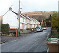
NE section of Llanarth Street, Chatham, Machen
View taken from about 100 metres NNE of Commercial Road (A468). The houses are located near a 90-degree bend in Llanarth Street ahead.
Image: © Jaggery
Taken: 14 Feb 2011
0.02 miles
5
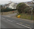
Speed camera sign, Chatham, Machen
Alongside the A468 Chatham near the corner of Chatham Street.
Image: © Jaggery
Taken: 4 Jan 2019
0.02 miles
6
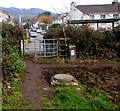
Kissing gate on the south side of the A468, Chatham, Machen
The gate gives walkers access to/from the public footpath through the field behind the camera.
Image: © Jaggery
Taken: 4 Jan 2019
0.02 miles
7
White semis on a Machen corner
Semi-detached houses on the corner of the A468 and Llanarth Street.
The house on the left is named River View. The river is the Rhymney.
Image: © Jaggery
Taken: 4 Jan 2019
0.02 miles
8
Western Power Distribution electricity substation, Chatham, Machen
Located at the edge of a field between the A468 and the Rhymney River.
The substation identifier is CHATHAM SW SITE S/S 541768
Image: © Jaggery
Taken: 4 Jan 2019
0.03 miles
9
Chatham Street, Machen
Ascending from the A468 Chatham. The sign on the right shows that Chatham Street leads to Chatham Place.
Image: © Jaggery
Taken: 4 Jan 2019
0.03 miles
10
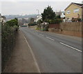
A468 Chatham, Machen
This part of the A468 is named Chatham. The Chatham Street junction https://www.geograph.org.uk/photo/6016828 is ahead on the right.
The wall on the left is above the Rhymney River.
Image: © Jaggery
Taken: 4 Jan 2019
0.04 miles


