1
Long hedge on a Machen wall
On the west side of the road ascending from The Crescent to the A468 Commercial Road.
Image: © Jaggery
Taken: 14 Mar 2019
0.02 miles
2
Up Commercial Road, Machen
The A468 Commercial Road ascends away from the centre of Machen towards Trethomas.
Image: © Jaggery
Taken: 14 Mar 2019
0.03 miles
3
Yellow grit box in Machen
Alongside the road ascending from The Crescent to Commercial Road.
Image: © Jaggery
Taken: 14 Mar 2019
0.03 miles
4
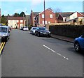
Road from The Crescent to the A468, Machen
Ascending northwards from the junction of The Crescent and Ffwrwm Road.
Image: © Jaggery
Taken: 14 Mar 2019
0.03 miles
5
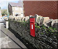
King George V postbox in a stone wall, Machen
On the approach to the Commercial Road junction. The GR on the box is short for Georgius Rex,
Latin for King George, in this case King George V who reigned from May 1910-January 1936.
Image: © Jaggery
Taken: 14 Mar 2019
0.03 miles
6
Dranllwyn Close, Machen
Viewed from Dranllwyn Lane.
Image: © Jaggery
Taken: 26 Feb 2011
0.04 miles
7
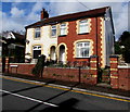
Semis above Commercial Road, Machen
The two semi-detached houses are set slightly above the north side of the A468 Commercial Road.
Image: © Jaggery
Taken: 14 Mar 2019
0.04 miles
8
Warning sign - cyclists, The Crescent, Machen
On the approach to National Cycle Network Route 4. https://www.geograph.org.uk/photo/6087573
Image: © Jaggery
Taken: 14 Mar 2019
0.04 miles
9
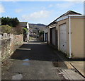
A back lane in Machen
Between the backs of Commercial Road houses on the left and houses in The Crescent on the right.
Image: © Jaggery
Taken: 14 Mar 2019
0.06 miles
10
The Crescent houses, Machen
Houses on the north side of The Crescent.
Image: © Jaggery
Taken: 26 Feb 2011
0.06 miles


