
IMAGES TAKEN NEAR TO
Alma Street, CAERPHILLY, CF83 8PT
Introduction
This page details the photographs taken nearby to Alma Street, CF83 8PT by members of the Geograph project.
The Geograph project started in 2005 with the aim of publishing, organising and preserving representative images for every square kilometre of Great Britain, Ireland and the Isle of Man.

There are currently over 7.5m images from over14,400 individuals and you can help contribute to the project by visiting https://www.geograph.org.uk
Image Map
Images are licensed for reuse under creativecommons.org/licenses/by-sa/2.0
Notes
- Clicking on the map will re-center to the selected point.
- The higher the marker number, the further away the image location is from the centre of the postcode.
Image Listing (192 Images Found)
Images are licensed for reuse under creativecommons.org/licenses/by-sa/2.0
Image
Details
Distance
1
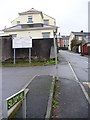
Siloam Hill, Machen
A steep hill rising immediately north from the village street, this lane has a religious name, probably coming from strong local chapel society.
Image: © Colin Smith
Taken: 7 Jan 2007
0.01 miles
2
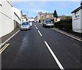
Steep ascent in Machen
From the north side of the A468 Commercial Road, Alma Street ascends towards Wyndham Street.
Image: © Jaggery
Taken: 14 Mar 2019
0.02 miles
3
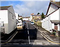
Up Alma Street, Machen
From the north side the A468 Commercial Road, Alma Street ascends towards Pandy Lane, Napier Street and Wyndham Street. The white arrow on a sign on the right points up Alma Street towards Ebenezer Evangelical Baptist Church.
Image: © Jaggery
Taken: 13 Dec 2019
0.02 miles
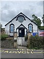
5
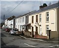
Wyndham Street, Machen
Houses on the north side of the street, viewed from the crossroads of Penrhiw Lane, Station Street and Lewis Street.
Image: © Jaggery
Taken: 26 Feb 2011
0.03 miles
6
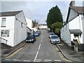
Alma Street, Machen
Alma Street rises steeply away from Commercial Road (A468) towards Wyndham Street.
Image: © Jaggery
Taken: 26 Feb 2011
0.03 miles
7
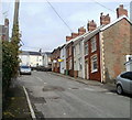
Houses at the top end of Alma Street, Machen
The row of houses are near the T-junction with Wyndham Street ahead. Behind the camera is a steep descent to Commercial Road (A468).
Image: © Jaggery
Taken: 26 Feb 2011
0.03 miles
8
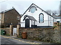
Ebenezer Evangelical Baptist Church, Machen
The church is on the north side of Wyndham Street, near the Alma Street junction.
Image: © Jaggery
Taken: 26 Feb 2011
0.03 miles
9
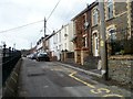
Machen : Wyndham Street west of Ebenezer church
Viewed from the edge of Ebenezer Evangelical Baptist Church. http://www.geograph.org.uk/photo/276301
Image: © Jaggery
Taken: 26 Feb 2011
0.03 miles
10
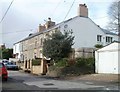
Station Street, Machen
Houses on the north side of Station Street, viewed from Church Street.
Passenger services at Machen railway station ceased in 1962.
Image: © Jaggery
Taken: 26 Feb 2011
0.04 miles