1
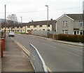
Southern end of Brynfedw, Bedwas
Viewed from railings at the corner of Hillside Terrace and Park Avenue.
Image: © Jaggery
Taken: 5 Mar 2011
0.04 miles
2
Football pitch in Trethomas
Viewed from The Bryn. Part of a recreation area which also contains a children's play area https://www.geograph.org.uk/photo/6032315 in its NE corner.
Image: © Jaggery
Taken: 24 Jan 2019
0.04 miles
3
Houses on the NW side of Bryn Field, Bedwas
The houses are at the SE ends of Bryn Heol, Bryn Canol and Bryn Awel.
Image: © Jaggery
Taken: 5 Mar 2011
0.05 miles
4
Bryn Heol, Bedwas
Bryn Heol is one of several http://www.geograph.org.uk/photo/2772757 residential streets on the NW side of Bryn Field.
Image: © Jaggery
Taken: 5 Mar 2011
0.06 miles
5
SE end of Brynglas, Bedwas
Looking SE towards Brynfedw.
Image: © Jaggery
Taken: 5 Mar 2011
0.10 miles
6
Park Avenue, Bedwas
A view SE from the corner of Hillside Terrace. Park Avenue is an 80 metre long cul-de-sac. The far end of the street is at the edge of Bedwas Comprehensive School.
Image: © Jaggery
Taken: 5 Mar 2011
0.11 miles
7
Corner of Hillside Terrace and Park Avenue, Bedwas
Viewed from Brynfedw. Hillside Terrace is on the right, Park Avenue http://www.geograph.org.uk/photo/2787926 on the left.
Image: © Jaggery
Taken: 5 Mar 2011
0.11 miles
8
Bedwas & Trethomas Community Hall
Located at the edge of Bryn Field. The community hall was officially opened on January 30th 2010.
Image: © Jaggery
Taken: 5 Mar 2011
0.11 miles
9
Children's play area in Trethomas
In the northeast corner of a recreation ground which also contains a football pitch. https://www.geograph.org.uk/photo/6032313
Image: © Jaggery
Taken: 24 Jan 2019
0.12 miles
10
Change of house type, Bedwas
Looking eastwards from Brynglas towards Brynfedw.
Image: © Jaggery
Taken: 5 Mar 2011
0.13 miles


