1
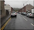
Navigation Street, Trethomas
Image: © Roger Cornfoot
Taken: 19 Mar 2007
0.01 miles
2
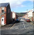
Car-lined Coronation Street, Trethomas
Looking north from Newport Road towards Standard Street in October 2019.
Image: © Jaggery
Taken: 7 Oct 2019
0.02 miles
3
Junction of Heol-yr-ysgol and Navigation Street, Trethomas
Viewed from Navigation Street. Ty'n-Y-Wern Primary School https://www.geograph.org.uk/photo/5876641 is on the right.
Image: © Jaggery
Taken: 10 Aug 2018
0.04 miles
4
Thomas Street, Trethomas
Viewed from the Newport Road end. Thomas Street is about 200 metres long. Its northern end connects with Standard Street.
Image: © Jaggery
Taken: 26 Feb 2011
0.04 miles
5
Trethomas Christian Fellowship
Located on Standard Street, between Coronation Street and Mary Street.
Image: © Jaggery
Taken: 26 Feb 2011
0.04 miles
6
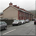
West side of Mary Street, Trethomas
Long row of houses extending northwards towards Standard Street.
Image: © Jaggery
Taken: 7 Oct 2019
0.04 miles
7
Navigation Street semis, Trethomas
Semi-detached houses on the east side of Navigation Street, north of this https://www.geograph.org.uk/photo/5949010 row of houses.
Image: © Jaggery
Taken: 10 Aug 2018
0.04 miles
8
Change of house type, Navigation Street, Trethomas
South of Standard Street, there are semi-detached houses in the northern section of Navigation Street, and a row of houses in the southern section.
Image: © Jaggery
Taken: 26 Feb 2011
0.05 miles
9
Ty'n-Y-Wern Primary School information board, Trethomas
On the right here. https://www.geograph.org.uk/photo/5876641
Image: © Jaggery
Taken: 10 Aug 2018
0.05 miles
10
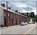
Row of houses, Navigation Street, Trethomas
On the approach to the A468 Newport Road.
Image: © Jaggery
Taken: 10 Aug 2018
0.05 miles


