
IMAGES TAKEN NEAR TO
The Crescent, CAERPHILLY, CF83 8AB
Introduction
This page details the photographs taken nearby to The Crescent, CF83 8AB by members of the Geograph project.
The Geograph project started in 2005 with the aim of publishing, organising and preserving representative images for every square kilometre of Great Britain, Ireland and the Isle of Man.

There are currently over 7.5m images from over14,400 individuals and you can help contribute to the project by visiting https://www.geograph.org.uk
Image Map
Images are licensed for reuse under creativecommons.org/licenses/by-sa/2.0
Notes
- Clicking on the map will re-center to the selected point.
- The higher the marker number, the further away the image location is from the centre of the postcode.
Image Listing (153 Images Found)
Images are licensed for reuse under creativecommons.org/licenses/by-sa/2.0
Image
Details
Distance
1
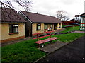
Metal bench near Newport Road bungalows, Bedwas
On the north side of Newport Road near a bus stop and shelter.
Image: © Jaggery
Taken: 25 Jan 2019
0.03 miles
2
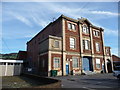
Bedwas Workmen's Hall & Institute
A fine example of a surviving workmen's hall and institute, dating from the 1920's (the era of the General Strike) and built to help make Britain 'a land fit for heroes' in the aftermath of the terrible Great War. So, a symbol of turbulent times when working men wanted to better themselves and their communities. Their legacy lives on here; today the building is used by an adult education organisation. Though sadly I don't expect it is still used for dances, cinema or as a meeting place where local men share ideas on community initiatives, politics or ideology.
Image: © Jeremy Bolwell
Taken: 7 Oct 2012
0.03 miles
3
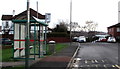
Council Offices bus stop & shelter, Newport Road, Bedwas
Located opposite Bedwas Council Offices. https://www.geograph.org.uk/photo/6032641 In January 2019 the bus stop sign shows that this is a stop on two routes - Route 50 to Newport and Route H to Graig-y-rhacca.
Image: © Jaggery
Taken: 25 Jan 2019
0.03 miles
4
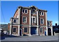
Workmen's Institute, Newport Road, Bedwas
Image: © Roger Cornfoot
Taken: 19 Mar 2007
0.03 miles
5
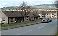
The Crescent bungalows, Bedwas
Looking north along The Crescent from the Newport Road end. The left turn ahead is into Glebe Street.
Image: © Jaggery
Taken: 5 Mar 2011
0.03 miles
6
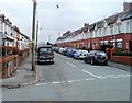
Glebe Street, Bedwas
Looking east from Celtic Way.
Image: © Jaggery
Taken: 5 Mar 2011
0.03 miles
7
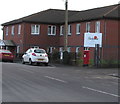
Queen Elizabeth II pillarbox on the corner of Parklands, Bedwas
On the northwest corner of Parklands Care Home viewed across Newport Road.
Image: © Jaggery
Taken: 25 Jan 2019
0.03 miles
8
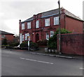
Bedwas Council Offices, Bedwas
The name in glass above the doorway of these Newport Road offices is
BEDWAS TRETHOMAS MACHEN COMMUNITY COUNCIL.
The original use of the building is recorded in stone above the doorway. It opened in 1914 for Bedwas and Machen Urban District Council (UDC), which was formed on October 1st 1912 from the parishes of Bedwas and Machen Upper, previously part of St Mellons Rural District. Bedwas and Machen UDC was abolished by the Local Government Act 1972, becoming part of Rhymney Valley District in Mid Glamorgan in 1974. In 2019 Bedwas is part of the County Borough of Caerphilly.
Image: © Jaggery
Taken: 25 Jan 2019
0.03 miles
9
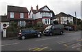
Housing variety, Newport Road, Bedwas
This part of Newport Road is between The Crescent and Celtic Way.
Image: © Jaggery
Taken: 25 Jan 2019
0.04 miles
10
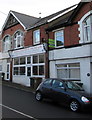
Bedwas Computers & Internet Cafe, Newport Road, Bedwas
Text on the nameboard in January 2019 includes
Computer repairs, Consumables, Internet - Refreshments.
Image: © Jaggery
Taken: 25 Jan 2019
0.07 miles