1
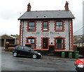
Former County Police Station, Senghenydd
Located on the corner of Gwern Avenue and Kingsley Place. Now a private residence, the former police station dates from 1904.
Image: © Jaggery
Taken: 27 Apr 2012
0.04 miles
2
Plas Cwm Parc flats, Senghenydd
This is the southern (Gwern Avenue) side of Plas Cwm Parc which contains about 60 flats.
Image: © Jaggery
Taken: 27 Apr 2012
0.04 miles
3
Senghenydd
Looking from the sheep grazing land down to the village. Note the older miners' row of terraced houses with painted brick and stone work and the newer row of bungalows in front of it.
Image: © Colin Smith
Taken: 24 Sep 2006
0.07 miles
4
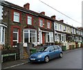
Station Terrace, Senghenydd
A view to NW from the Gwern Avenue junction. The site of Senghenydd railway station, which closed in 1964, is nearby.
Image: © Jaggery
Taken: 27 Apr 2012
0.07 miles
5
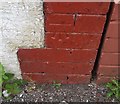
Ordnance Survey Cut Mark
This OS cut mark can be found on No41 Station Terrace. It marks a point 191.122m above mean sea level.
Image: © Adrian Dust
Taken: 25 May 2019
0.07 miles
6
Ordnance Survey Cut Mark
This OS cut mark can be found on No11 Gwern Avenue. It marks a point 182.127m above mean sea level.
Image: © Adrian Dust
Taken: 25 May 2019
0.07 miles
7
Footbridge over Nant Cwm-parc near Kingsley Place, Senghenydd
The footbridge connects Commercial Street on the left side with Kingsley Place on the right. The stream Nant Cwm-parc is vigorous during a wet period in late April 2012.
Image: © Jaggery
Taken: 27 Apr 2012
0.07 miles
8
Nant Cwm-parc flows towards Kingsley Place footbridge, Senghenydd
Vigorous during a wet period in late April 2012, the stream flows towards this http://www.geograph.org.uk/photo/2922581 footbridge.
Image: © Jaggery
Taken: 27 Apr 2012
0.07 miles
9
Nant Cwm-parc flows away from Kingsley Place footbridge, Senghenydd
Vigorous during a wet period in late April 2012, the stream flows away from this http://www.geograph.org.uk/photo/2922581 footbridge.
Image: © Jaggery
Taken: 27 Apr 2012
0.07 miles
10
Leigh Social Club, Senghenydd, viewed from the north
Looking across Commercial Street.
Image: © Jaggery
Taken: 27 Apr 2012
0.08 miles


