
IMAGES TAKEN NEAR TO
Hill Road, CAERPHILLY, CF83 4HE
Introduction
This page details the photographs taken nearby to Hill Road, CF83 4HE by members of the Geograph project.
The Geograph project started in 2005 with the aim of publishing, organising and preserving representative images for every square kilometre of Great Britain, Ireland and the Isle of Man.

There are currently over 7.5m images from over14,400 individuals and you can help contribute to the project by visiting https://www.geograph.org.uk
Image Map
Images are licensed for reuse under creativecommons.org/licenses/by-sa/2.0
Notes
- Clicking on the map will re-center to the selected point.
- The higher the marker number, the further away the image location is from the centre of the postcode.
Image Listing (76 Images Found)
Images are licensed for reuse under creativecommons.org/licenses/by-sa/2.0
Image
Details
Distance
1
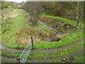
Glan Nant SE of Woodland Terrace, Senghenydd
A stream, Glan Nant, flows under a track near an unnamed road SE of Woodland Terrace.
Image: © Jaggery
Taken: 27 Apr 2012
0.03 miles
2
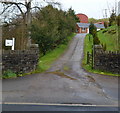
Entrance road to Woodland Farm, Senghenydd
The farm specialises in breeding pigs.
Image: © Jaggery
Taken: 27 Apr 2012
0.03 miles
3
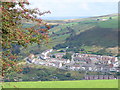
Head of the Valley, Senghenydd
The former miners' row down in the valley below is lined on both sides by newer housing. Hill farms occupy the hill tops.
Image: © Colin Smith
Taken: 24 Sep 2006
0.03 miles
4
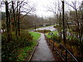
Path descending towards Senghenydd turning circle
The turning circle is the terminus of Stagecoach bus route B from Caerphilly.
A children's playground https://www.geograph.org.uk/photo/2920296 is on the right.
Image: © Jaggery
Taken: 15 Mar 2019
0.05 miles
5
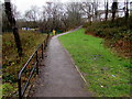
Path towards a children's playground, Senghenydd
The playground https://www.geograph.org.uk/photo/2920296 is ahead on the left.
Image: © Jaggery
Taken: 15 Mar 2019
0.06 miles
6
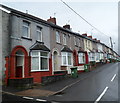
Woodland Terrace Senghenydd
This is the SW end of Woodland Terrace, a 120 metre long row of 22 houses.
All the houses in Woodland Terrace are on this side of the street.
Image: © Jaggery
Taken: 27 Apr 2012
0.06 miles
7
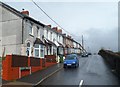
Phillips Terrace Senghenydd
This is the SW end of Phillips Terrace, a 110 metre long row of 20 houses.
All the houses in Phillips Terrace on this side of the street.
Image: © Jaggery
Taken: 27 Apr 2012
0.06 miles
8
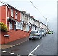
Graig Terrace, Senghenydd
This is the SW end of Graig Terrace, a 220 metre long row of 38 houses.
All the houses in Graig Terrace are on this side of the street.
Image: © Jaggery
Taken: 27 Apr 2012
0.06 miles
9
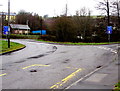
Two blue weight limit signs at a Senghenydd road junction
Both signs show a 7.5 tonnes vehicle weight limit.
The sign on the left shows that the weight limit applies 330 yards ahead.
The sign on the right shows that the weight limit applies 460 yards ahead.
Image: © Jaggery
Taken: 15 Mar 2019
0.06 miles
10
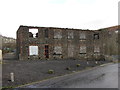
Derelict offices of the former Universal Colliery
Image: © Gareth James
Taken: 19 Jan 2014
0.09 miles