IMAGES TAKEN NEAR TO
High Street, CAERPHILLY, CF83 4GH
Introduction
This page details the photographs taken nearby to High Street, CF83 4GH by members of the Geograph project.
The Geograph project started in 2005 with the aim of publishing, organising and preserving representative images for every square kilometre of Great Britain, Ireland and the Isle of Man.

There are currently over 7.5m images from over14,400 individuals and you can help contribute to the project by visiting https://www.geograph.org.uk
Image Map
Images are licensed for reuse under creativecommons.org/licenses/by-sa/2.0
Notes
- Clicking on the map will re-center to the selected point.
- The higher the marker number, the further away the image location is from the centre of the postcode.
Image Listing (127 Images Found)
Images are licensed for reuse under creativecommons.org/licenses/by-sa/2.0
Image
Details
Distance
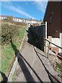
3
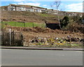
Path from Stanley Street to High Street, Senghenydd
Image: © Jaggery
Taken: 26 Mar 2019
0.04 miles
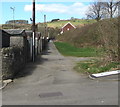
4
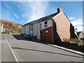
High Street houses on top of a hill, Senghenydd
Looking east from the entrance to the Mining Memorial & Garden site.
Image: © Jaggery
Taken: 26 Mar 2019
0.05 miles
5
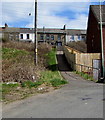
Footpath and steps from Commercial St to High St, Senghenydd
Image: © John Lord
Taken: 5 Oct 2017
0.05 miles
6
Back lane on the NW side of Cross Street, Senghenydd
Between Commercial Street and Stanley Street.
Image: © Jaggery
Taken: 26 Mar 2019
0.06 miles
7
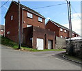
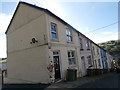
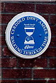
Stanley Street houses on the site of Aberdare Hall, Senghenydd
The Walking Through Time blue plaque https://www.geograph.org.uk/photo/6101917 on the wall shows Aberdare Hall.
Image: © Jaggery
Taken: 26 Mar 2019
0.07 miles
8
Cross Street, Senghenydd
A view from Commercial Street along Cross Street, looking towards High Street.
Image: © Jaggery
Taken: 27 Apr 2012
0.07 miles
9
Aberdare Hall blue plaque, Senghenydd
The Caerphilly County Borough Council Walking Through Time blue plaque is on the wall here. https://www.geograph.org.uk/photo/6101914
Image: © Jaggery
Taken: 26 Mar 2019
0.08 miles
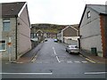
10
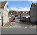
Up Cross Street, Senghenydd
From the B4263 Commercial Street, Cross Street ascends towards Stanley Street and High Street.
Image: © Jaggery
Taken: 26 Mar 2019
0.08 miles