1
Information board on the wall of the Church of St Peter and St Cenydd, Senghenydd
On display on the far left here https://www.geograph.org.uk/photo/6100686 in March 2019.
Image: © Jaggery
Taken: 26 Mar 2019
0.01 miles
2
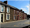
Commercial Street houses between two churches, Senghenydd
Viewed from the edge of the United Reformed Church. https://www.geograph.org.uk/photo/6100713
The Church of St Peter and St Cenydd https://www.geograph.org.uk/photo/2926935 is beyond the house on the right.
Image: © Jaggery
Taken: 26 Mar 2019
0.01 miles
3
Church of St Peter and St Cenydd, Commercial Street, Senghenydd
Church in Wales church in the Parish of Eglwysilan in the Church in Wales Diocese of Llandaff. Part of the church's name recalls the hermit Cenydd (or Kenneth) who in the 6th century established a monastery in Caerphilly, and possibly an ancient church at Senghenydd, named Capel Y Cenydd. As with most references dating back 15 centuries, there is some uncertainty about the precise details. The name Senghenydd appears to be a form of the Welsh for Saint Cenydd.
Image: © Jaggery
Taken: 26 Mar 2019
0.01 miles
4
Commercial St, Senghenydd, approaching the junction with Caerphilly Rd
Image: © John Lord
Taken: 5 Oct 2017
0.01 miles
5
Church of St Peter and St Cenydd
Image: © Alan Hughes
Taken: 1 Aug 2021
0.01 miles
6
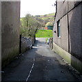
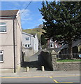
This way to Senghenydd Park, Senghenydd
From Commercial Street the side road leads to Senghenydd Park https://www.geograph.org.uk/photo/2927005 https://www.geograph.org.uk/photo/2927025 https://www.geograph.org.uk/photo/2927014
Image: © Jaggery
Taken: 26 Mar 2019
0.01 miles
7
Church of St Peter & St Cenydd, Senghenydd
Image: © John Lord
Taken: 5 Oct 2017
0.02 miles
8
Lane from Commercial Street to Caerphilly Road, Senghenydd
Past the edge of the Church of St Peter & St Cenydd. https://www.geograph.org.uk/photo/5562398
Image: © Jaggery
Taken: 26 Mar 2019
0.02 miles
9
Church car park in Senghenydd
On the southeast side of the Church of St Peter and St Cenydd viewed from the Caerphilly Road entrance.
Image: © Jaggery
Taken: 26 Mar 2019
0.02 miles
10
The Square, Senghenydd
A fork in the road is occupied by the war memorial / clock tower. Note the bilingual sign of the Post Office and the former miners' cottages lining the road.
Image: © Colin Smith
Taken: 24 Sep 2006
0.02 miles


