
IMAGES TAKEN NEAR TO
Caerphilly Road, CAERPHILLY, CF83 4FS
Introduction
This page details the photographs taken nearby to Caerphilly Road, CF83 4FS by members of the Geograph project.
The Geograph project started in 2005 with the aim of publishing, organising and preserving representative images for every square kilometre of Great Britain, Ireland and the Isle of Man.

There are currently over 7.5m images from over14,400 individuals and you can help contribute to the project by visiting https://www.geograph.org.uk
Image Map
Images are licensed for reuse under creativecommons.org/licenses/by-sa/2.0
Notes
- Clicking on the map will re-center to the selected point.
- The higher the marker number, the further away the image location is from the centre of the postcode.
Image Listing (112 Images Found)
Images are licensed for reuse under creativecommons.org/licenses/by-sa/2.0
Image
Details
Distance
1
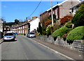
Unclassified part of Caerphilly Road, Senghenydd
The B4263 Caerphilly Road is behind the camera. This unclassified part of the road leads to Clive Street and Commercial Street.
Image: © Jaggery
Taken: 26 Mar 2019
0.04 miles
2
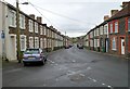
Caerphillly Road, Senghenydd
Viewed from the corner of Clive Street. http://www.geograph.org.uk/photo/2926880
The sign on the left, a white arrow on a blue background,
indicates one-way traffic ahead, away from the camera.
Image: © Jaggery
Taken: 27 Apr 2012
0.05 miles
4
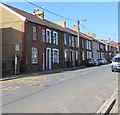
West side of the B4263 Commercial Street, Senghenydd
The shadow on the side wall is being cast by the United Reformed Church. https://www.geograph.org.uk/photo/6100713
Image: © Jaggery
Taken: 26 Mar 2019
0.05 miles
5
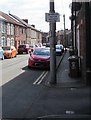
Windsor Motor Repairs direction sign, Senghenydd
The sign alongside Commercial Street points towards the garage https://www.geograph.org.uk/photo/6115765 30 metres away.
Image: © Jaggery
Taken: 26 Mar 2019
0.05 miles
6
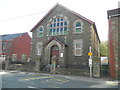
United Reformed Church, Commercial Rd, Senghenydd
Congregational, Baptist & Methodist Fellowship.
Image: © John Lord
Taken: 5 Oct 2017
0.07 miles
7
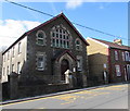
United Reformed Church, Commercial Street, Senghenydd
In March 2019 the United Reformed Church information board https://www.geograph.org.uk/photo/6100724 shows Congregational, Baptist and Methodist Fellowship. A Walking Through Time blue plaque https://www.geograph.org.uk/photo/6100729 on the building shows English Congregational Church. Coflein records that the building was erected in 1896 as Senghenydd English Independent Chapel.
Image: © Jaggery
Taken: 26 Mar 2019
0.07 miles
8
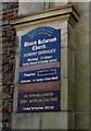
United Reformed Church information board, Senghenydd
On display at the entrance here https://www.geograph.org.uk/photo/6100713 in March 2019.
Image: © Jaggery
Taken: 26 Mar 2019
0.07 miles
9
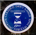
English Congregational Church blue plaque, Senghenydd
The Caerphilly County Borough Council Walking Through Time blue plaque is on a gate pier here. https://www.geograph.org.uk/photo/6100713
In March 2019 the church is a United Reformed Church.
Image: © Jaggery
Taken: 26 Mar 2019
0.07 miles
10
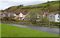
A view NE from Senghenydd Park
Looking towards high ground beyond houses in Commercial Street and Caerphilly Road.
The railings are at the edge of a stream, Nant Cwm-parc. http://www.geograph.org.uk/photo/2926958
Image: © Jaggery
Taken: 27 Apr 2012
0.07 miles