1
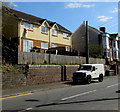
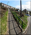
Semis above Caerphilly Road, Senghenydd
Two semi-detached houses set above the east side of the B4263 Caerphilly Road.
Image: © Jaggery
Taken: 26 Mar 2019
0.03 miles
2
Queen Elizabeth II pillarbox, Caerphilly Road, Senghenydd
Viewed in March 2019. The BT phonebox near the pillarbox
in an October 2015 Google Street View has been removed.
Image: © Jaggery
Taken: 26 Mar 2019
0.03 miles
3
Houses in Caerphilly Rd, Senghenydd
Image: © John Lord
Taken: 5 Oct 2017
0.04 miles
4
Bus stops and a shelter, Caerphilly Road, Senghenydd
The stop on the shelter side of the road is for buses to Caerphilly. The stop on the camera side is for buses to the centre of the village, the Mining Memorial & Garden and the Senghenydd turning circle at the end of the bus route.
Image: © Jaggery
Taken: 26 Mar 2019
0.04 miles
5
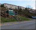
Tan-y-bryn houses, Senghenydd
Viewed from Caerphilly Road looking past a dark green electricity substation. https://www.geograph.org.uk/photo/6101167
Image: © Jaggery
Taken: 26 Mar 2019
0.04 miles
6
Atlanta Buildings, Senghenydd
The building is set about a metre above road level on the east side of Caerphilly Road. A sign on the building shows Flats 1-6. There are only 5 wheelie bins at the roadside...
Image: © Jaggery
Taken: 27 Apr 2012
0.05 miles
7
Long ramp up to Tan-y-bryn, Senghenydd
Viewed from the junction of Commercial Street and Caerphilly Road. A 50 metre long ramp ascends towards houses in Tan-y-bryn.
Image: © Jaggery
Taken: 27 Apr 2012
0.05 miles
8
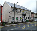
St Catherines Court, Senghenydd
Large building, divided into flats, on the west side of Caerphilly Road between numbers 124 and 126.
Image: © Jaggery
Taken: 27 Apr 2012
0.06 miles
9
Seion 1901 inscription, Senghenydd
The Welsh inscription is on this https://www.geograph.org.uk/photo/2927449 former chapel.
Image: © Jaggery
Taken: 26 Mar 2019
0.07 miles
10
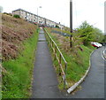
Shadows on a long steep path in Senghenydd
From Caerphilly Road towards houses in Tan-y-bryn.
Image: © Jaggery
Taken: 26 Mar 2019
0.07 miles


