
IMAGES TAKEN NEAR TO
High Street, CAERPHILLY, CF83 4FE
Introduction
This page details the photographs taken nearby to High Street, CF83 4FE by members of the Geograph project.
The Geograph project started in 2005 with the aim of publishing, organising and preserving representative images for every square kilometre of Great Britain, Ireland and the Isle of Man.

There are currently over 7.5m images from over14,400 individuals and you can help contribute to the project by visiting https://www.geograph.org.uk
Image Map
Images are licensed for reuse under creativecommons.org/licenses/by-sa/2.0
Notes
- Clicking on the map will re-center to the selected point.
- The higher the marker number, the further away the image location is from the centre of the postcode.
Image Listing (75 Images Found)
Images are licensed for reuse under creativecommons.org/licenses/by-sa/2.0
Image
Details
Distance
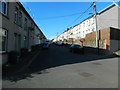
2
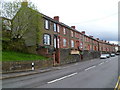
Houses at the northern end of High Street, Abertridwr
The houses in this part of High Street are all on the east side of the road.
On the west side is a steep slope down to the valley of a large stream, Nant Cwm-parc.
Image: © Jaggery
Taken: 27 Apr 2012
0.02 miles
4
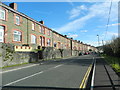
South along High Street, Abertridwr
Houses are on only one side of this part of the B4263 High Street. Ahead for Trecenydd and Caerphilly.
Image: © Jaggery
Taken: 26 Mar 2019
0.02 miles

6

Ordnance Survey Cut Mark
This OS cut mark can be found on the north angle of the school. It marks a point 176.415m above mean sea level.
Image: © Adrian Dust
Taken: 25 May 2019
0.06 miles
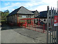
8
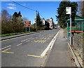
High Street bus stop and shelter, Abertridwr
This stop on the east side of the B4263 is for buses to Caerphilly.
Image: © Jaggery
Taken: 26 Mar 2019
0.07 miles
9
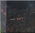
Ordnance Survey Cut Mark
This OS cut mark can be found on No37 Bryngelli Terrace. It marks a point 187.470m above mean sea level.
Image: © Adrian Dust
Taken: 25 May 2019
0.07 miles
10
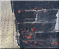
Ordnance Survey Cut Mark
This OS cut mark can be found on No103A High Street. It marks a point 162.532m above mean sea level.
Image: © Adrian Dust
Taken: 25 May 2019
0.08 miles