
IMAGES TAKEN NEAR TO
Dan Y Graig, CAERPHILLY, CF83 4BJ
Introduction
This page details the photographs taken nearby to Dan Y Graig, CF83 4BJ by members of the Geograph project.
The Geograph project started in 2005 with the aim of publishing, organising and preserving representative images for every square kilometre of Great Britain, Ireland and the Isle of Man.

There are currently over 7.5m images from over14,400 individuals and you can help contribute to the project by visiting https://www.geograph.org.uk
Image Map
Images are licensed for reuse under creativecommons.org/licenses/by-sa/2.0
Notes
- Clicking on the map will re-center to the selected point.
- The higher the marker number, the further away the image location is from the centre of the postcode.
Image Listing (70 Images Found)
Images are licensed for reuse under creativecommons.org/licenses/by-sa/2.0
Image
Details
Distance
1
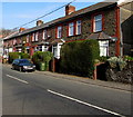
Stone houses, Thomas Street, Abertridwr
On the right here. https://www.geograph.org.uk/photo/6107663
Image: © Jaggery
Taken: 1 Apr 2019
0.06 miles
2
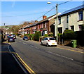
West along Thomas Street, Abertridwr
Along the B4263 Thomas Street towards the centre of the village.
Image: © Jaggery
Taken: 1 Apr 2019
0.07 miles
3
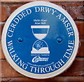
Aber Mill blue plaque, Abertridwr
The Caerphilly County Borough Council Walking Through Time Welsh/English plaque is on the wall here. https://www.geograph.org.uk/photo/6107645 Aber Mill was the village watermill.
Image: © Jaggery
Taken: 1 Apr 2019
0.07 miles
4
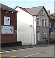
Little Care Break name sign, Thomas Street, Abertridwr
The sign on the right here https://www.geograph.org.uk/photo/6107635 is below the Abermill Care Home name sign.
Image: © Jaggery
Taken: 1 Apr 2019
0.07 miles
5
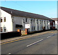
Abermill Care Home, Thomas Street, Abertridwr
On the site of the former Aber Mill which was the village watermill.
Image: © Jaggery
Taken: 1 Apr 2019
0.07 miles
6
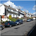
Semi-detached houses, King Street, Abertridwr
There are contrasting house types on King Street. Behind the camera are older terraced houses. http://www.geograph.org.uk/photo/2934491 Ahead, viewed looking towards Dan-y-graig, are newer semi-detached houses.
Image: © Jaggery
Taken: 1 May 2012
0.08 miles
7
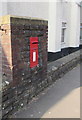
Queen Elizabeth II postbox outside Abermill Care Home, Abertridwr
Located behind the bus stop here. https://www.geograph.org.uk/photo/6107635
Image: © Jaggery
Taken: 1 Apr 2019
0.08 miles
8
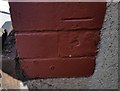
Ordnance Survey Cut Mark
This OS cut mark can be found on No174 Thomas Street. It marks a point 143.716m above mean sea level.
Image: © Adrian Dust
Taken: 25 May 2019
0.09 miles
9
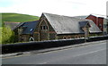
Former school house, Abertridwr
Set below road level on the south side of Thomas Street, this boarded-up derelict building was formerly a school house.
Image: © Jaggery
Taken: 1 May 2012
0.09 miles
10
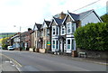
Thomas Street houses, Abertridwr
The B4263 is the main road through Abertridwr. This is the eastern section of the road, named Thomas Street.
Image: © Jaggery
Taken: 1 May 2012
0.09 miles