1
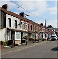
King Street houses, Abertridwr
Houses on the north side of King Street viewed from the corner of Kings Close.
Image: © Jaggery
Taken: 28 Mar 2019
0.02 miles
2
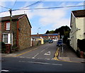
Northern end of Aberfawr Road, Abertridwr
From the B4263 Thomas Street, Aberfawr Road ascends to King Street.
Image: © Jaggery
Taken: 28 Mar 2019
0.02 miles
3
King St, Abertridwr
Image: © John Lord
Taken: 17 Sep 2010
0.04 miles
4
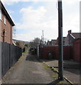
Back lane in Abertridwr
From Kings Close to Aberfawr Road.
Image: © Jaggery
Taken: 28 Mar 2019
0.04 miles
5
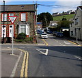
Crossroads in Abertridwr
The B4263 Thomas Street (camera side and ahead) intersects Aberfawr Road.
Image: © Jaggery
Taken: 28 Mar 2019
0.06 miles
6
ILDIWCH/GIVE WAY sign, Aberfawr Road, Abertridwr
Viewed in March 2019. The Welsh/English sign on the corner of Thomas Street
has replaced the English-only sign shown in a July 2011 Google Street View.
Image: © Jaggery
Taken: 28 Mar 2019
0.06 miles
7
Spar, 57 Thomas Street, Abertridwr
On the corner of Aberfawr Road. The blue plaque https://www.geograph.org.uk/photo/6102947 on the building shows Old Food Store & Dance Hall.
Image: © Jaggery
Taken: 28 Mar 2019
0.06 miles
8
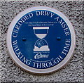
Blue plaque on the wall of Spar, Abertridwr
The Caerphilly County Borough Council Walking Through Time blue plaque on the wall here https://www.geograph.org.uk/photo/6102938 shows Old Food Store & Dance Hall and its Welsh equivalent.
Image: © Jaggery
Taken: 28 Mar 2019
0.06 miles
9
Aber Valley YMCA, Brynhafod Road, Abertridwr
This YMCA building was built in 1939 by the local coal company.
There have been various modifications and extensions since then.
Image: © Jaggery
Taken: 28 Mar 2019
0.06 miles
10
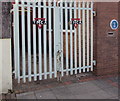
YMCA gates, Brynhafod Road, Abertridwr
On the left here. https://www.geograph.org.uk/photo/6103576
https://www.geograph.org.uk/photo/6103580 to the blue plaque.
Image: © Jaggery
Taken: 28 Mar 2019
0.06 miles


