
IMAGES TAKEN NEAR TO
Thomas Street, CAERPHILLY, CF83 4AZ
Introduction
This page details the photographs taken nearby to Thomas Street, CF83 4AZ by members of the Geograph project.
The Geograph project started in 2005 with the aim of publishing, organising and preserving representative images for every square kilometre of Great Britain, Ireland and the Isle of Man.

There are currently over 7.5m images from over14,400 individuals and you can help contribute to the project by visiting https://www.geograph.org.uk
Image Map
Images are licensed for reuse under creativecommons.org/licenses/by-sa/2.0
Notes
- Clicking on the map will re-center to the selected point.
- The higher the marker number, the further away the image location is from the centre of the postcode.
Image Listing (194 Images Found)
Images are licensed for reuse under creativecommons.org/licenses/by-sa/2.0
Image
Details
Distance
1
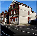
Former commercial premises on an Abertridwr corner
This building on the corner of Thomas Street and Kings Close
has been converted to residential use. Viewed in April 2019.
Image: © Jaggery
Taken: 1 Apr 2019
0.00 miles
2
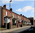
Row of stone houses, Thomas Street, Abertridwr
On the north side of the B4263 here named Thomas Street.
Image: © Jaggery
Taken: 28 Mar 2019
0.01 miles
3
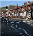
Zebra crossing, Thomas Street, Abertridwr
Five white stripes across the B4263 Thomas Street viewed from the corner of Cross Street. Although Belisha beacons had marked pedestrian crossings in the UK from 1934, it was not until 1951 that the now familiar black and white stripes stretching across the width of the road were officially introduced. Previously, there were only metal studs across the road surface.
Image: © Jaggery
Taken: 1 Apr 2019
0.01 miles
4
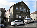
Abertridwr Community Church and Beulah Baptist Chapel, Abertridwr
The Thomas Street side of the church on the corner of Cross Street.
In March 2019 the building is used by Abertridwr Community Church https://www.geograph.org.uk/photo/6106865 and Beulah Baptist Chapel. https://www.geograph.org.uk/photo/6106872
The Welsh inscription on the tablet above the central window is
BEULAH CAPEL Y BEDYDDWYR (Beulah Baptist Chapel) 1905.
Image: © Jaggery
Taken: 28 Mar 2019
0.02 miles
5
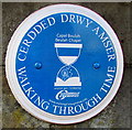
Beulah Chapel blue plaque, Abertridwr
The Caerphilly County Borough Council Walking Through Time Welsh/English blue plaque is on the wall behind the car here. https://www.geograph.org.uk/photo/6102980
Image: © Jaggery
Taken: 1 Apr 2019
0.02 miles
6
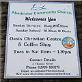
Abertridwr Community Church information board
On the wall on the left side of the doorway here. https://www.geograph.org.uk/photo/6102980 The building is also used by Beulah Baptist Chapel. https://www.geograph.org.uk/photo/6106872
Image: © Jaggery
Taken: 1 Apr 2019
0.02 miles
7
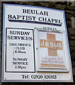
Beulah Baptist Chapel information board, Thomas Street, Abertriwdr
On the wall on the right side of the doorway here. https://www.geograph.org.uk/photo/6102980
The building is also used by Abertridwr Community Church. https://www.geograph.org.uk/photo/6106865
Image: © Jaggery
Taken: 1 Apr 2019
0.02 miles
8
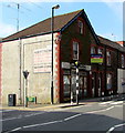
Derelict shop on an Abertridwr corner
On March 28th 2019 a For Sale board is on the derelict shop on the corner of Thomas Street and Cross Street.
A white-on-red UNDER OFFER label is on the board.
Image: © Jaggery
Taken: 28 Mar 2019
0.02 miles
9
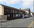
Row of houses, Thomas Street, Abertridwr
On the south side of the B4263 Thomas Street on the approach to Abertridwr Community Church. https://www.geograph.org.uk/photo/6102980
Image: © Jaggery
Taken: 28 Mar 2019
0.02 miles
10
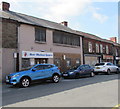
Aber Medical Centre, Abertridwr
On the south side of the B4263 Thomas Street.
Image: © Jaggery
Taken: 28 Mar 2019
0.02 miles