
IMAGES TAKEN NEAR TO
Abertridwr, CAERPHILLY, CF83 4AG
Introduction
This page details the photographs taken nearby to CF83 4AG by members of the Geograph project.
The Geograph project started in 2005 with the aim of publishing, organising and preserving representative images for every square kilometre of Great Britain, Ireland and the Isle of Man.

There are currently over 7.5m images from over14,400 individuals and you can help contribute to the project by visiting https://www.geograph.org.uk
Image Map
Images are licensed for reuse under creativecommons.org/licenses/by-sa/2.0
Notes
- Clicking on the map will re-center to the selected point.
- The higher the marker number, the further away the image location is from the centre of the postcode.
Image Listing (170 Images Found)
Images are licensed for reuse under creativecommons.org/licenses/by-sa/2.0
Image
Details
Distance
1
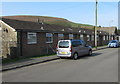
William Harries Bungalows, Abertridwr
South of, and parallel with, the B4263 Thomas Street. Originally, bungalow was used in English for a lightly-built house, with a veranda and one storey. In current UK usage it is a convenient word for any one-storey dwelling.
Image: © Jaggery
Taken: 1 Apr 2019
0.01 miles
2
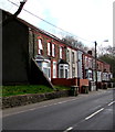
Thomas Street houses and wheelie bins, Abertridwr
On the north side of the B4263 Thomas Street.
Image: © Jaggery
Taken: 28 Mar 2019
0.03 miles
3
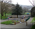
Children's playground in Abertridwr
In Abertridwr Park viewed from the Aberfawr Road park entrance.
Image: © Jaggery
Taken: 28 Mar 2019
0.05 miles
4
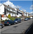
Semi-detached houses, King Street, Abertridwr
There are contrasting house types on King Street. Behind the camera are older terraced houses. http://www.geograph.org.uk/photo/2934491 Ahead, viewed looking towards Dan-y-graig, are newer semi-detached houses.
Image: © Jaggery
Taken: 1 May 2012
0.05 miles
5
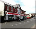
Spar, 57 Thomas Street, Abertridwr
On the corner of Aberfawr Road. The blue plaque https://www.geograph.org.uk/photo/6102947 on the building shows Old Food Store & Dance Hall.
Image: © Jaggery
Taken: 28 Mar 2019
0.06 miles
6
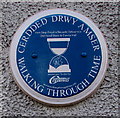
Blue plaque on the wall of Spar, Abertridwr
The Caerphilly County Borough Council Walking Through Time blue plaque on the wall here https://www.geograph.org.uk/photo/6102938 shows Old Food Store & Dance Hall and its Welsh equivalent.
Image: © Jaggery
Taken: 28 Mar 2019
0.06 miles
7
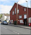
Dragon's Den Fitness Centre, Abertridwr
Entrance from Aberfawr Road near the corner of Thomas Street.
Image: © Jaggery
Taken: 28 Mar 2019
0.06 miles
8
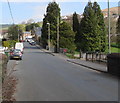
North along Aberfawr Road, Abertridwr
Towards the B4263 Thomas Street. An entrance to Abertridwr Park https://www.geograph.org.uk/photo/6103029 is on the right.
Image: © Jaggery
Taken: 28 Mar 2019
0.06 miles
9
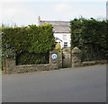
Hedge-lined perimeter of an Aberfawr Road house, Abertridwr
The blue plaque https://www.geograph.org.uk/photo/6102997 shows Old Aberfawr Farmhouse.
Image: © Jaggery
Taken: 28 Mar 2019
0.07 miles
10
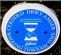
Old Aberfawr Farmhouse blue plaque, Aberfawr Road, Abertridwr
The Caerphilly County Borough Council Walking Through Time blue plaque on the wall here https://www.geograph.org.uk/photo/6102995 shows
Old Aberfawr Farmhouse and its Welsh equivalent.
Image: © Jaggery
Taken: 28 Mar 2019
0.07 miles