1
Pen-y-cae, Mornington Meadows
Part of a large housing estate, to the north of Caerphilly.
Image: © Roger Cornfoot
Taken: 19 Mar 2007
0.06 miles
2
Pen-y-cae houses, Caerphilly
Houses in the Morningtom Meadows area in the NE of Caerphilly.
Image: © Jaggery
Taken: 17 Aug 2011
0.10 miles
3
Pen-y-cae houses, Lansbury Park, Caerphilly
The houses are on the north side of St James Primary School.
Image: © Jaggery
Taken: 17 Aug 2011
0.11 miles
4
Life Express shop, Pen-y-cae, Caerphilly
The shop is opposite the Gwaun Hyfryd junction, in the NE of Caerphilly.
Image: © Jaggery
Taken: 17 Aug 2011
0.11 miles
5
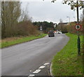
National Cycle Network Route 4, Caerphilly
Viewed across the unnamed ring road skirting the eastern edge of residential Caerphilly. A blue sign on the right points along National Cycle Network Route 4. Sturdy metal posts prevent unsuitable vehicles using the cycle route.
Image: © Jaggery
Taken: 17 Aug 2011
0.11 miles
6
No pedestrians ahead, Caerphilly
Viewed from Rudry Road. There are no pavements ahead, along a 150 metre long road connecting with the unnamed ring road skirting the eastern edge of residential Caerphilly. The circular sign with a red edge indicates no pedestrians allowed.
Image: © Jaggery
Taken: 18 Nov 2011
0.12 miles
7
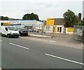
Caerphilly Hand Car Wash
Located at the southern edge of a group of business premises on the east side of Bedwas Road (B4600). Next door is Castle Discount Tyres.
Image: © Jaggery
Taken: 17 Aug 2011
0.13 miles
8
Three businesses, Bedwas Road, Caerphilly
On the left is Pee Gee Motorcycles.
On the right is Castle Discount Tyres.
The small shop in the middle is PMC Butchers.
Image: © Jaggery
Taken: 17 Aug 2011
0.13 miles
9
Pearce & Sons, Bedwas Road, Caerphilly
Located at the northern end of a small row of businesses on the east side of Bedwas Road (B4600). Products and services available include car brakes, electrics and servicing; clutch repairs; oil change; MoT vehicle testing.
Image: © Jaggery
Taken: 17 Aug 2011
0.13 miles
10
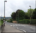
Zebra crossing, Bedwas Road, Caerphilly
Combined Belisha beacons and street lamps are alongside the B4600 Bedwas Road.
Ahead for Caerphilly town centre.
Image: © Jaggery
Taken: 19 Jun 2019
0.15 miles


