1
Pen-y-cae houses, Caerphilly
Houses in the Morningtom Meadows area in the NE of Caerphilly.
Image: © Jaggery
Taken: 17 Aug 2011
0.02 miles
2
Porset Row, Caerphilly
A named row of houses on the south side of Old Bedwas Road. Porset Farm http://www.geograph.org.uk/photo/2558017 is nearby, on the opposite side of the road.
Image: © Jaggery
Taken: 17 Aug 2011
0.07 miles
3
A row of three houses, Old Bedwas Road, Caerphilly
The houses are near the Rudry junction and face Porset Farm. http://www.geograph.org.uk/photo/2558017
Image: © Jaggery
Taken: 17 Aug 2011
0.07 miles
4
National Cycle Network Route 4, Caerphilly
Viewed across the unnamed ring road skirting the eastern edge of residential Caerphilly. A blue sign on the right points along National Cycle Network Route 4. Sturdy metal posts prevent unsuitable vehicles using the cycle route.
Image: © Jaggery
Taken: 17 Aug 2011
0.08 miles
5
West View or Westview Terrace, Rudry Road, Caerphilly
The street name sign disagrees with maps I've consulted (not an unprecedented occurrence!). The sign, to the right of the pole, shows West View, whereas two maps show the track on the left as Westview Terrace.
Image: © Jaggery
Taken: 17 Aug 2011
0.10 miles
6
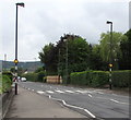
Zebra crossing, Bedwas Road, Caerphilly
Combined Belisha beacons and street lamps are alongside the B4600 Bedwas Road.
Ahead for Caerphilly town centre.
Image: © Jaggery
Taken: 19 Jun 2019
0.11 miles
7
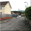
Old Bedwas Road, Caerphilly
The road ahead ends at the edge of Pont Porset and Porset Brook.
Formerly the route of Bedwas Road which is now to the west and north.
Image: © Jaggery
Taken: 19 Jun 2019
0.11 miles
8
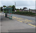
Bus stop and shelter on the east side of Bedwas Road, Caerphilly
In June 2019 the bus stop sign shows that this is a stop on
three bus routes: A, 50, 50A. Ahead for Caerphilly town centre.
Image: © Jaggery
Taken: 19 Jun 2019
0.11 miles
9
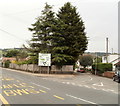
Bedwas Road and Old Bedwas Road, Caerphilly
On the right is Old Bedwas Road, the former course of Bedwas Road. The realignment of the road to the route on the left was needed because of the construction of a bypass, which cuts the old route in half (out of shot ahead).
Image: © Jaggery
Taken: 17 Aug 2011
0.11 miles
10
Unnamed ring road between Caerphilly and Bedwas
Image: © Colin Pyle
Taken: 17 Dec 2013
0.11 miles


