1
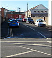
Entrance to Virginia Park rugby ground, Caerphilly
Located at the eastern end of Virginia Close. Virginia Park is the home ground of Caerphilly RFC (rugby football club). Though the ground was open for anyone to walk around, a sign on the right warns of a maximum penalty of £1000 for exercising dogs on the field.
Image: © Jaggery
Taken: 19 May 2011
0.04 miles
2
West stand and Cafe Verde, Virginia Park, Caerphilly
Virginia Park is the home ground of Caerphilly RFC (rugby football club). In view of the colour of the buildings, it is no surprise that Caerphilly RFC play in green shirts.
Image: © Jaggery
Taken: 19 May 2011
0.06 miles
3
Clubhouse, Virginia Park, Caerphilly
Located on the west side of Virginia Park rugby ground, http://www.geograph.org.uk/photo/2416288 the home venue of Caerphilly RFC.
The ground is on the east side of Pontygwindy Road (A469).
Image: © Jaggery
Taken: 19 May 2011
0.06 miles
4
Home Bargains, Caerphilly
Located on the east side of Pontygwindy Road (A469).
TJ Morris Ltd, trading as Home Bargains, is one of the UK's fastest growing discount retailers. In early 2011, there were more than 200 of its stores in the UK. The firm's expansion target is for at least 500 stores by 2018.
Image: © Jaggery
Taken: 19 May 2011
0.08 miles
5
The Green Lady
A local pub that has an interesting clock tower. The building is reputed to be haunted.
Image: © Gail Franklin
Taken: 21 Nov 2010
0.09 miles
6
Grandstand, Virginia Park, Caerphilly
The grandstand occupies almost all of the eastern side of Virginia Park rugby football ground, the home venue of Caerphilly RFC.
Image: © Jaggery
Taken: 19 May 2011
0.10 miles
7
Former St Ilan Comprehensive School, Caerphilly
Set back from the west side of Pontygwindy Road (A469). The school was closed in 2007, because of reducing numbers of students enrolled. Some maps show the buildings now as 'Television Studios' but the sign on the left of the view shows 'Community Education Centre'.
Image: © Jaggery
Taken: 19 May 2011
0.12 miles
8
Waun Ganol Street, Caerphilly
From Pontygwindy Road along Waun Ganol Street towards Caerphilly Fire Station. https://www.geograph.org.uk/photo/2416325
Image: © Jaggery
Taken: 17 Jan 2019
0.12 miles
9
The Green Lady, Caerphilly
Pub on the corner of Pontygwindy Road (A469) and Heol Bro Wen.
The Green Lady is a Caerphilly legend, based partly on fact.
Nearby Caerphilly Castle was built in the 13th century by Gilbert de Clare. His wife, Princess Alice of Angouleme had a clandestine love affair with Gruffudd the Fair, Prince of Brithdir. When her husband found out, he had Gruffudd murdered. It is said that Alice dropped dead on hearing of the death of her lover, and has haunted Caerphilly Castle ever since, dressed in green to represent her husband's envy.
Image: © Jaggery
Taken: 19 May 2011
0.12 miles
10
Junction of Heol Bro Wen and Pontygwindy Road, Caerphilly
The sign pointing right along Heol Bro Wen shows Leisure centre - golf course and their Welsh equivalents.
Image: © Jaggery
Taken: 17 Jan 2019
0.13 miles


