1
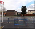
Plas y Felin Junior School in 2001
Plas Y Felin Junior school photographed in 2001
Image: © Eddie Reed
Taken: 12 Jan 2001
0.07 miles
2
Plas y Felin Junior School in 2001
Plas Y felin Junior School in 2001
Image: © Eddie Reed
Taken: 12 Jan 2001
0.07 miles
3
Mill View
New residential houses in Caerphilly.
Image: © Wayland Smith
Taken: 8 Aug 2021
0.08 miles
4
Islwyn Drive, Churchill Park, Caerphilly
Looking east from the Lewis Drive end.
Image: © Jaggery
Taken: 17 Jan 2014
0.17 miles
5
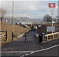
Railway underpass near Energlyn & Churchill Park railway station, Caerphilly
This is the eastern path connecting the station with Lewis Drive ahead. The path passes under the railway a few metres from the newly built station (officially opened in December 2013).
Image: © Jaggery
Taken: 17 Jan 2014
0.17 miles
6
Lewis Drive postbox, Churchill Park, Caerphilly
Facing an entrance to Energlyn & Churchill Park railway station. The postbox used to be on the opposite side of the road. It was moved here to make space for the erection of the safety railings seen here. http://www.geograph.org.uk/photo/3934713
Image: © Jaggery
Taken: 17 Jan 2014
0.17 miles
7
Lewis Drive railway station exit path railings, Churchill Park, Caerphilly
The railings are at the end of the eastern exit from Energlyn & Churchill Park railway station.
The postbox http://www.geograph.org.uk/photo/3934702 used to be on this side of the road. It was moved to make space for these railings during work on the construction of the new railway station, which was officially opened in December 2013.
Image: © Jaggery
Taken: 17 Jan 2014
0.17 miles
8
Western entrance to Energlyn & Churchill Park railway station, Caerphilly
From Llwyn-on Street. Triangular plaques record the official opening of the station
on December 16th 2013 by Edwina Hart, Minister for Economy, Science and Transport.
Image: © Jaggery
Taken: 17 Jan 2014
0.18 miles
9
Eastern access path to Energlyn & Churchill Park railway station, Caerphilly
From Lewis Drive. The railway underpass leads to steps up to the station.
Image: © Jaggery
Taken: 17 Jan 2014
0.18 miles
10
Caerphilly Fire Station
South Wales Fire and Rescue Service fire station located on the corner of Waunfach Street and Waun Ganol Street. The station was built in 2002, replacing an earlier one built in 1959. In addition to the town of Caerphilly, the station serves the neighbouring communities of Llanbradach, Machen, Nantgarw, Rudry and Senghenydd.
The station's training tower is on the right.
Image: © Jaggery
Taken: 19 May 2011
0.19 miles


