1
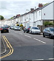
Plas y Felin Junior School in 2001
Plas Y Felin Junior school photographed in 2001
Image: © Eddie Reed
Taken: 12 Jan 2001
0.05 miles
2
Plas y Felin Junior School in 2001
Plas Y felin Junior School in 2001
Image: © Eddie Reed
Taken: 12 Jan 2001
0.05 miles
3
Mill View
New residential houses in Caerphilly.
Image: © Wayland Smith
Taken: 8 Aug 2021
0.09 miles
4
Caerphilly Fire Station
South Wales Fire and Rescue Service fire station located on the corner of Waunfach Street and Waun Ganol Street. The station was built in 2002, replacing an earlier one built in 1959. In addition to the town of Caerphilly, the station serves the neighbouring communities of Llanbradach, Machen, Nantgarw, Rudry and Senghenydd.
The station's training tower is on the right.
Image: © Jaggery
Taken: 19 May 2011
0.17 miles
5
St Helen's Catholic Church, Caerphilly
The church, built in the 1960s, is dedicated to St Helen. Saint Helen (Latin: Flavia Iulia Helena Augusta) also known as Saint Helena, Helena Augusta or Helena of Constantinople (c 250–330) was the consort of Emperor Constantius, and the mother of Emperor Constantine I, the first Christian Roman emperor.
Image: © Jaggery
Taken: 21 Apr 2010
0.19 miles
6
St Helen's Presbytery, Caerphilly
The presbytery (priests' house) is adjacent to St Helen's Catholic Church. http://www.geograph.org.uk/photo/1817556
Image: © Jaggery
Taken: 21 Apr 2010
0.19 miles
7
Former St Ilan Comprehensive School, Caerphilly
Set back from the west side of Pontygwindy Road (A469). The school was closed in 2007, because of reducing numbers of students enrolled. Some maps show the buildings now as 'Television Studios' but the sign on the left of the view shows 'Community Education Centre'.
Image: © Jaggery
Taken: 19 May 2011
0.20 miles
8
Dol-y-felin Street, Caerphilly
Houses on the north side of the street, viewed from near the corner of Pontygwindy Road (A469).
Image: © Jaggery
Taken: 19 May 2011
0.20 miles
9
Caerphilly Players' Rehearsal Hall
The Caerphilly Players Amateur Dramatics Society hall is on Nantgarw Road. Rehearsals are on most Wednesdays. The Players perform plays of various genres, including classics, comedies, thrillers, mysteries and farces.
Image: © Jaggery
Taken: 21 Apr 2010
0.20 miles
10
Spring in Caerphilly
Daffodils blooming on the parkland between Crescent and Nantgarw Roads, west of Caerphilly Castle.
Image: © Colin Smith
Taken: 3 Apr 2011
0.23 miles


