IMAGES TAKEN NEAR TO
Nantgarw Road, CAERPHILLY, CF83 3FA
Introduction
This page details the photographs taken nearby to Nantgarw Road, CF83 3FA by members of the Geograph project.
The Geograph project started in 2005 with the aim of publishing, organising and preserving representative images for every square kilometre of Great Britain, Ireland and the Isle of Man.

There are currently over 7.5m images from over14,400 individuals and you can help contribute to the project by visiting https://www.geograph.org.uk
Image Map
Images are licensed for reuse under creativecommons.org/licenses/by-sa/2.0
Notes
- Clicking on the map will re-center to the selected point.
- The higher the marker number, the further away the image location is from the centre of the postcode.
Image Listing (425 Images Found)
Images are licensed for reuse under creativecommons.org/licenses/by-sa/2.0
Image
Details
Distance
1
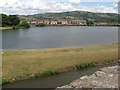
Nantgarw Road, Caerphilly
Residential road in central Caerphilly, overlooking the northern moat of the castle.
Image: © Colin Smith
Taken: 3 Apr 2011
0.01 miles
2
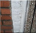
Ordnance Survey Cut Mark
This OS cut mark can be found on No15 Nantgarw Road. It marks a point 87.182m above mean sea level.
Image: © Adrian Dust
Taken: 20 Jul 2018
0.01 miles
3
![Caerphilly Castle [10]](https://s3.geograph.org.uk/geophotos/07/36/02/7360203_d1ad0264_120x120.jpg)
Caerphilly Castle [10]
The view looking north-northeast from the North-West Tower.
Caerphilly Castle, occupying some 30 acres (12 hectares), is the second largest medieval fortification in the United Kingdom. Located in the centre of the town of Caerphilly, some 7 miles north of Cardiff, the castle was built in the 13th century. Constructed mainly of local pennant sandstone with dressings of Sutton stone and of Jurassic limestone. The core of the castle, including the luxurious accommodation, was built on a central island, surrounded by several artificial lakes. By the mid 14th century, the castle was essentially disused, although it was maintained until the late 15th century. The ruins were acquired by the Bute family in 1776 and the 3rd and 4th Marquesses carried out the full restoration. In 1950 the castle and grounds were given to the state and the water defences were re-flooded. Now in the care of Cadw, the castle is open to the public. Listed, grade I, with details at: https://cadwpublic-api.azurewebsites.net/reports/listedbuilding/FullReport?lang=&id=13539 A Scheduled Ancient Monument with details at: https://cadwpublic-api.azurewebsites.net/reports/sam/FullReport?lang=&id=2848
Image: © Michael Dibb
Taken: 2 Sep 2022
0.01 miles
4
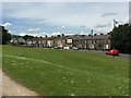
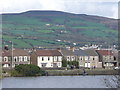
Terraced houses
A row of terraced houses on Nantgarw Road facing Caerphilly Castle.
Image: © Alan Hughes
Taken: 5 Jun 2019
0.03 miles
5
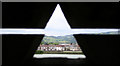
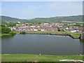
Caerphilly Street from the Castle ramparts
Image: © Matt Rosser
Taken: 11 Apr 2007
0.03 miles
6
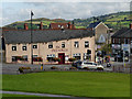
The Piccadilly
The Piccadilly restaurant on Nantgarw Road, Caerphilly.
Image: © David Dixon
Taken: 30 Aug 2012
0.04 miles
7
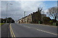
Row of houses at the bottom end of Nantgarw Road Caerphilly
A photograph of a row of houses at the bottom end of Nantgarw road leading down to the Piccadilly Pub in Caerphilly.
Image: © Eddie Reed
Taken: 8 Feb 2010
0.05 miles
8
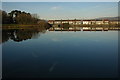
Houses reflected in North Lake, Caerphilly
Houses on Nantgarw Road reflected in the still waters of North Lake which forms part of the defences at Caerphilly Castle.
Image: © Philip Halling
Taken: 15 Dec 2008
0.06 miles