IMAGES TAKEN NEAR TO
Rudry, CAERPHILLY, CF83 3DG

Introduction

This page details the photographs taken nearby to CF83 3DG by members of the Geograph project.

The Geograph project started in 2005 with the aim of publishing, organising and preserving representative images for every square kilometre of Great Britain, Ireland and the Isle of Man.

There are currently over 7.5m images from over14,400 individuals and you can help contribute to the project by visiting https://www.geograph.org.uk

Image Map


Images are licensed for reuse under creativecommons.org/licenses/by-sa/2.0
Notes
  • Clicking on the map will re-center to the selected point.
  • The higher the marker number, the further away the image location is from the centre of the postcode.

Image Listing (7 Images Found)

Images are licensed for reuse under creativecommons.org/licenses/by-sa/2.0
Image
Details
Distance
1
Nant Gwaunybara near Caerphilly
The stream Nant Gwaunybara is a tributary of the Rhymney River, into which it flows about 700 metres ahead.
Image: © Jaggery Taken: 18 Nov 2011
0.03 miles
2
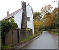
Distinctive chimney stack near Caerphilly
The house is alongside the road from Rudry to Caerphilly.
Image: © Jaggery Taken: 18 Nov 2011
0.03 miles
3
Side road to a farm near Caerphilly
Viewed from near the corner of the road from Rudry to Caerphilly. The flattish land ahead is in the valley of a stream, Nant Gwaunybara.
Image: © Jaggery Taken: 18 Nov 2011
0.11 miles
4
Bend in the road opposite Ty-yr-efail
Viewed along the road from Rudry to Caerphilly. A yellow grit box is at the roadside
Image: © Jaggery Taken: 18 Nov 2011
0.14 miles
5
Branch Cottages near Caerphilly
Viewed from the road from Rudry to Caerphilly. At the left edge of the view is Branch Cottage Boarding Kennels and Cattery. http://www.geograph.org.uk/photo/3063308
Image: © Jaggery Taken: 18 Nov 2011
0.22 miles
6
Entrance to Branch Cottage Boarding Kennels and Cattery near Caerphilly
Viewed along the Caerphilly to Rudry road.
Image: © Jaggery Taken: 18 Nov 2011
0.22 miles
7
Moorland and track to the north of Mynydd Rudry.
Image: © Colin Park Taken: 19 Feb 2010
0.24 miles